The sprawling inland empire of California might not be the first place you think of to explore the outdoors. But in reality, it’s surrounded by gorgeous national forests, state parks, and natural areas. From the desert of Joshua Tree National Park to the forest covered granite peaks of the San Jacinto Mountains, there’s a ton of wilderness packed into this area. Our one tank trip from San Bernardino, California will take you to from the valley floor to the mountain peaks, all on one tank of gas!
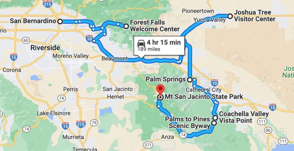
This one tank trip from San Bernardino takes about 4 hours and 15 minutes to drive and is 189 miles. Of course, exploring some of these great national parks and forests can make the milage longer depending on where you go.
San Bernardino
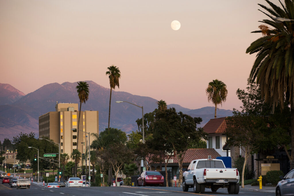
Before you head out on your one tank trip, take some time to explore San Bernardino. This city is on the original Historic Route 66, and you’ll still fine a few throwbacks to when it was a major highway. For example, stop by the original McDonald’s location that is now a State Historic Site. This location isn’t your typical fast food restaurant, it’s a museum with all sorts of historic McDonald’s memorabilia. The city also hosts a Route 66 themed classic car show in the fall.
If ancient history is more your thing, stop by the Robert and Frances Fullerton Museum of Art which houses a collection of ancient Egyptian artifacts as well as art from other parts of Africa, Asia, and the Middle East. And if you’re a railroad buff, don’t miss the San Bernardino History and Railroad Museum for a look at the history of the railroad industry in San Bernardino.
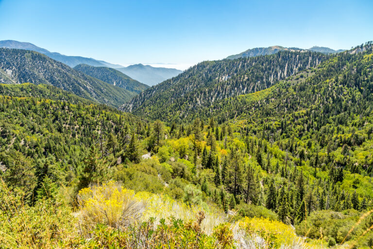
San Bernardino National Forest
The San Bernardino National Forest is on the city’s doorstep and is packed with places to explore. With seven wilderness areas, multiple lakes and rivers, miles of hiking trails, and even several ski resorts, there’s always something to do. Take some time to hike throughout the national forest. A portion of the Pacific Crest National Scenic Trail (that goes from the Mexican to the Canadian border) runs through the forest, and there are many other hikes to explore. You can check out one of the ranger stations for maps and information about the hiking trails.
If you love to fish, the streams and lakes of this national forest are the place to go. They’re stocked with catfish, bluegill, rainbow trout, and bass. Or head to one of the reservoirs like Silverwood Lake or Big Bear Lake for swimming, boating and relaxing. The town of Big Bear is also fun to check out.
If you’d rather stay in the car to see the sights, the Rim of the World Scenic Byway takes you more than 5,000 feet above the city for incredible panoramic views. Although with all the elevation changes and switchbacks we recommend leaving your rig at the campground and just taking your tow car for that drive!
Joshua Tree National Park
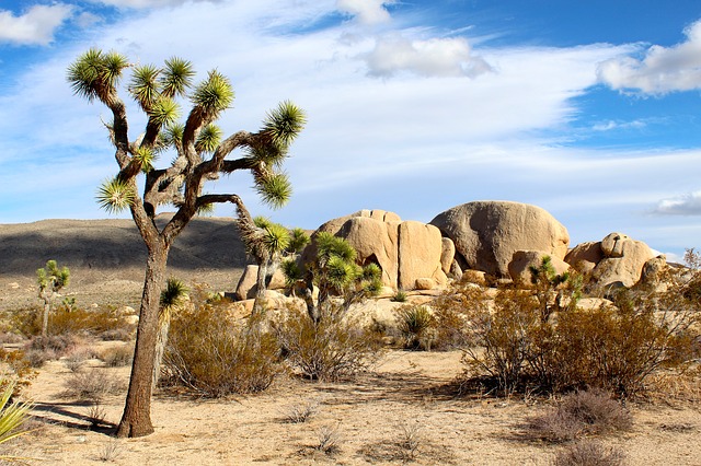
After your trip through the national forest, it’s time for a national park. Joshua Tree National Park is one of those surreal and almost alien looking landscapes that is popular with both locals and visitors. Located where the Mojave and Colorado Deserts meet, this national park is over 1,200 miles of desert, mountains, rock formations, and of course those crazy looking Joshua Tree plants.
Stop by the visitor’s center to grab a map of the many hiking trails throughout the park or drive your car through the park to see the scenic vistas. It’s a popular place for hiking, mountain biking, climbing, and background camping. And due to its remote location, the stargazing at night is fantastic. There are many ranger-led events throughout the year that you can join to learn more about the park.
Palm Springs
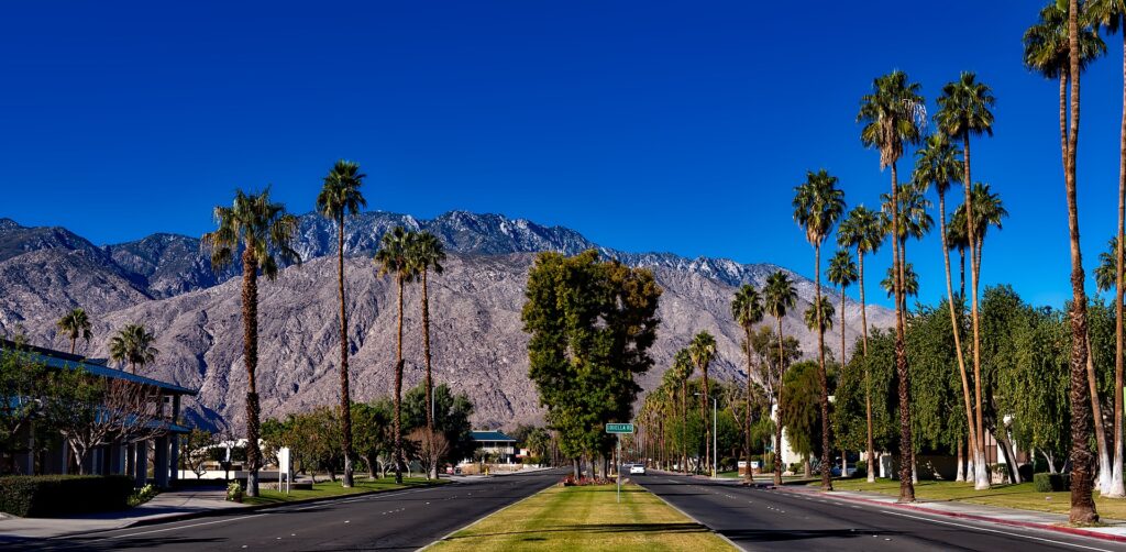
After experiencing the forest and the barren desert, it’s time for a stop in a city. Head south of Joshua Tree National Park to the artsy city of Palm Springs. Start your visit with epic views from the sky on the Palm Springs Aerial Tramway. It’s the largest rotating cable car in the world and it takes you from the floor of the desert up towards the top of San Jacinto Peak.
Back on the ground, take in some of the mid century art that makes Palm Springs so iconic with a self-driving architecture tour of the historic and famous houses, or stop by the Palm Springs Art Museum. And if shopping and eating are on your list, head to North Palm Canyon Drive. This street is packed with shops, restaurants, and galleries to explore.
If you want to enjoy that desert heat, spend time outdoors at the Moorten Botanical Garden or at one of the many golf courses around town. The Living Desert Zoo and Garden is a great option for kids and adults alike. And don’t miss Tahquitz Canyon for some time in nature and to learn about the Cahuilla people. It’s just outside town and has a two mile long loop trail that takes you past the waterfall.
Santa Rosa and San Jacinto Mountains National Monument
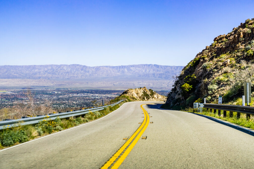
Then it’s time to head to the next stop on this trip. The Santa Rosa and San Jacinto Mountains National Monument is just south of Palm Springs and is about 280,000 acres of wilderness. This is a mix of both BLM and U.S. Forest Service land, which means there’s plenty of places to hike, bike, and even camp. And because it’s so large, you’ll find multiple landscapes including both the desert and snowcapped mountains.
Part of the drive on this trip takes you along the popular Palms to Pines Scenic Byway. This scenic drive starts at the Visitor Center in Palm Desert and takes you into the national monument lands. There are some great viewpoints to stop at along the way to grab the perfect selfie like the Coachella Valley Vista Point.
This national monument is very popular with backcountry camping if you want to spend a few days out in total wilderness. The Pacific Crest Trail also runs through the area, bringing many hikers to the park. But if you’re not into backcountry camping that’s no problem. Since much of it is BLM land, that means there’s plenty of dispersed camping areas available for RVs as well.
Mt San Jacinto State Park
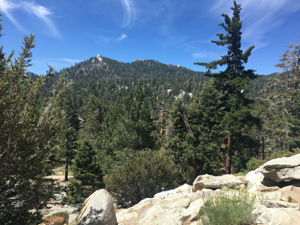
The last stop on this one tank trip before you head back to San Bernardino is Mt San Jacinto State Park. This state park is part of the San Jacinto mountain range has a variety of mountain landscapes to explore like forests, meadows, and peaks. If you took a trip on the Palm Springs Aerial Tramway, you would have seen some of this park. But now it’s time to explore the rest of it.
Spend your time hiking with over 50 miles of trails through the sub-alpine forest. A portion of the Pacific Crest Trail also passes through this state park if you want to add that hike to your list. Or gawk at Mount San Jacinto, the second tallest peak in Southern California. The park is free to enter and it is open sunrise to sunset throughout the year.
And don’t miss exploring the mountain town of Idyllwild. There are several campgrounds in the area that can accommodate RVs if you’re looking to stay a few days and enjoy the mountain air. There’s also a ranger station in Idyllwild that is open daily from 8 a.m. to 4 p.m. where you can find maps and information about the park.
Take a One Tank Trip
One tank trips are a great way to explore locally without spending so much on gas. If you’re looking for other great one tank itineraries check out the list below.
And don’t forget to head over to RVshare.com if you need an RV rental to start exploring!