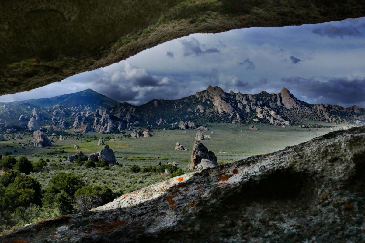
City of Rocks National Reserve
- Home
- National Sites
- Idaho
- City of Rocks National Reserve
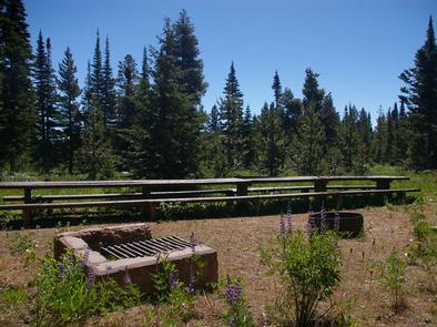
Far from the isolated freeways that run across southern Idaho, a bizarre rock garden springs from the foothills of the Albion Mountains. This is the City of Rocks National Reserve, a collection of unusually shaped granite formations and towering spires. As you hike through the rocks, keep an eye out for the axle grease and the names scratched into the stone — they're remnants of the pioneers who crossed through the area in covered wagons. The "Silent City" is more than a geological wonder; for thousands of years, it's been a crossroads for Native Americans, emigrants, stagecoach travelers, and homesteaders. Today, it's an outdoor playground packed with opportunities for rock climbing, camping, biking, fishing, scenic driving, and winter sports.
Things To Do Near City of Rocks National Reserve
The City of Rocks National Reserve offers activities for every type of adventurer. For a laid-back day, drive the scenic park road, practice your landscape photography, or break out your binoculars to spot birds and the occasional moose. Active travelers can hike and bike 22 miles of trails, go rock-climbing, or ride horses through the rocks. Don't let the winter snow keep you away — come for ice climbing, snowshoeing, skiing, and snowmobiling. The park is relatively isolated, so make sure to stop in Burley for groceries on your way in.
 Hiking Trails
-
Geological Interpretive Trail
Short but fascinating, the Geological Interpretive Trail offers a great introduction to the rock formations in the City of Rocks. Over 1.2 miles, you'll pass by a variety of enormous, bizarre towers and mounds. Learn about the history and geology as you pass and read 12 different interpretive signs. With its relatively flat surface and modest elevation gain, this is the ideal hike for families or beginners.
Location
Circle Creek Overlook parking lot
Length
1.2 Miles Round Trip
Intensity
Easy to Moderate
-
Window Arch Trail
If you have limited time, the Window Arch Trailis a great stop. The trail itself takes just a few minutes to navigate, but it takes you to a beautiful rock arch. This hike is particularly beautiful at sunrise or sunset.
Location
Window Arch parking area
Length
0.1 Miles Round Trip
Intensity
Easy
-
North Fork Circle Creek Trail
If you're looking for a longer hike, head to the North Fork Circle Creek Trail. Take two vehicles, and leave one at each trailhead for a one-way trip, or do an out-and-back for a full-day adventure. The trail winds through the rock spires, giving you fantastic views of the major formations and the beautiful Horizons Arch. In some sections, you'll climb high into a sagebrush plateau, surrounded by spectacular vistas. If you're hiking in the summer, bring plenty of water; much of the trail is exposed, and the sun can be intense.
Location
Emery Picnic Area parking lot
Length
6.3 Miles One-Way
Intensity
Moderate to Strenuous
 Sightseeing
-
Camp Rock
One of the most significant sites in City of Rocks National Reserve, Camp Rock is a must-see location. As emigrants passed through the area on the California Trail in the mid-1800s, they signed their names on the rock itself. Today, you can still see many of the signatures; they're written in axle grease and have survived more than 150 years.
Location
Camp Rock wayside
-
Elephant Rock
If you've ever seen photos of City of Rocks National Reserve, chances are good that they've included Elephant Rock. This distinctive rock dome has been weathered over the centuries to resemble an enormous elephant on the move. You can enjoy the view from the parking area or explore the rock on the short trails. Keep an eye out for climbers — Elephant Rock has several popular climbing routes.
Location
Elephant Rock parking lot
-
Parking Lot Rock
Bring your camera to Parking Lot Rock. With its fantastic views of tall rock towers and distant mountain peaks, it's one of the most scenic spots in the park. A variety of trails lead away from the parking area, giving you plenty of opportunities to get close to the rock formations. This is another popular spot for climbers, so you may see their tiny figures high on the sheer walls.
Location
Parking Lot Rock parking area
 Museums
-
Cassia County Historical Society and Museum
The Cassia County Historical Society and Museum takes you through the history of southern Idaho. Learn about the farming tradition, pioneers, railroads, and more. The photos, memorabilia, and historic buildings are engaging for both kids and adults.
Location
1142 Hiland Ave, Burley, ID 83318
-
Minidoka County Historical Society Museum
Small and charming, the Minidoka County Historical Society Museum is packed with interesting exhibits. Check out prehistoric fossils, view a 1900s-era soda fountain, and explore a caboose from the Union Pacific Railroad. Of particular interest is the exhibit about Hunt Camp, which operated as a Japanese relocation camp in World War II.
Location
99 E Baseline Rd, Rupert, ID 83350
Nearby Shops and Restaurants
-
Tracy General Store
Drive 5 miles to find the Tracy General Store, a small shop that carries basic household supplies, food, and snacks.
Location
3001 S Elba Almo Rd, Almo, ID 83312
-
Clark's
Clark's is a tiny grocery store located about 18 miles north of the park; it's the last store you'll find on the way south from Burley. Make sure to check out the historic building and to stop in the excellent meat department for food to grill at your campsite.
Location
100 E Main St, Oakley, ID 83346
-
Almo Creek Outpost Steakhouse
Located next to the Almo Inn, the Almo Creek Outpost Steakhouse serves hearty, meat-and-potatoes meals. Whether you're in the mood for a burger or a ribeye, you'll leave full and satisfied.
Location
3020 S Elba Almo Rd, Almo, ID 83312
-
Black Pine Steakhouse
Located about 28 miles from the City of Rocks National Reserve, the Black Pine Steakhouse is a great place to stop on your way into or out of the park. The lunch menu includes burgers and hot sandwiches, and dinner features ribs, steak, and shrimp.
Location
420 N Main St, Malta, ID 83342
How To Get To City of Rocks National Reserve
If you're driving across Idaho on I-86 or I-84, you can get to the City of Rocks National Reserve by taking ID-27 south from Burley or ID-77 south from Declo. Coming from Utah on I-84 north, take UT-30/UT-42 west near Snowville. Just after you cross the border into Idaho, head west on E Naf Road S. After about 75 miles, take S Yost Road north and E Ey Road west. Just south of Almo, ID, follow signs to the City of Rocks along E 3075 S.
Address
3035 Elba-Almo Road, Almo, ID 83312
Fee: Entry Fee (per person)
There is no entry fee.
Most tourists bypass the City of Rocks National Reserve; it usually sees fewer than 150,000 visitors per year. The drive to this remote southern Idaho destination pays off in spectacular hiking, rock climbing, biking, and horseback riding. Whether you're coming in the heat of summer or in the cold, windy winter, an RV makes a cozy and comfortable home base for your visit.