Apache-Sitgreaves National Forest Guide
- Home
- National Forests
- Arizona
- Apache-Sitgreaves National Forest
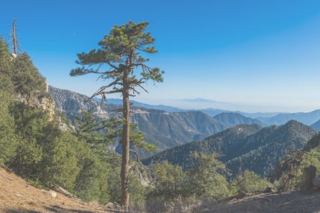
Camping in Apache-Sitgreaves National Forest can be a memorable experience. Spanning over 2 million acres in east-central Arizona, this is a paradise for outdoor enthusiasts. The forest is home to the iconic Mogollon Rim, eight cold-water lakes, and many rivers and streams for fishing, boating, and scenic exploration. Visitors can enjoy diverse ecosystems, from towering pines to lush meadows and year-round recreational activities.
Camping in Apache-Sitgreaves National Forest
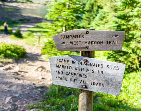
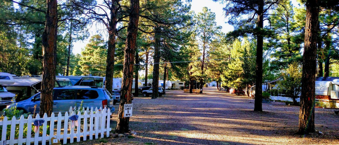
Camping in Apache-Sitgreaves National Forest is possible via paid campgrounds and free dispersed camping options. You can also explore top campgrounds in Arizona when planning your trip to the forest. To ensure a hassle-free camping experience, locate BLM camping options and dump stations near Apache-Sitgreaves National Forest with RVshare.
Here are some campgrounds for you to explore in Apache-Sitgreaves National Park:
Paid Campgrounds in Apache-Sitgreaves National Forest
Black Canyon Rim Campground $20/night. $12 extra vehicle charge
$14–$125 per night
Non-electrical sites $34 per night, with a $12 extra vehicle fee
$10–$125 per night
$24–$315 per night
$18–$30 per night
Free Campgrounds
Free
Day use only, Free
Free
Free
Free
Campgrounds by Lakes/Rivers for Fishing and Water Activities
$26.00–$375.00 per night
$20–$80 per night
$10.00–$20.00 per night
$8.00–$55.00 per night
$16.00–$55.00 per night
-
Rim Campground
Stay close to the beautiful Mogollon Rim at the Rim Campground. A short hike from your site, you can see for more than 100 miles. This campground offers 26 sites; some can be reserved in advance while others are first-come, first-served. Your nightly fee gives you a fire pit, a grill, and a picnic table. This is a Forest Service campground, so there are no hookups, but you'll find drinking water, trash collection, and vault toilets a short walk from camp. Sites are $18 per night.
-
Oxbow RV Park
Stay near the western edge of the Apache-Sitgreaves National Forest at Oxbow RV Park, which is located in Payson. Drive your RV into a campsite tucked under tall trees, and enjoy the peaceful, family-friendly setting. All of the sites come with full hookups, cable TV, a picnic table, and a grill, so you can relax completely after a day of adventure. The campground offers bathrooms, hot showers, and a laundry room. Rates start at $45 per night with discounts for weekly and monthly stays.
-
Sinkhole Campground
Sleep just minutes from hiking, fishing, and boating opportunities at the Sinkhole Campground. Pull into one of the 26 sites in the ponderosa-pine forest and enjoy the shade and cool breezes. In addition to private picnic tables and fire rings, your site comes with access to drinking water and vault toilets. Willow Springs Lake is just 1 mile away. Sites range from $20 to $22 per night depending on the time of year.
-
Arizona High Country Campground
Escape the desert heat at the Arizona High Country Campground, which offers warm, beautiful summer weather. Located near the northeastern side of the forest, this spot offers everything you need for a comfortable trip, including Wi-Fi, hot showers, clean bathrooms, and full hookups. If you need a propane refill, you can buy it at the camp store. Ten of the campsites offer pull-through access for big rigs. The campground is open from April to October, and rates start at $35 per night.
RV Rentals Near Apache-Sitgreaves National Forest
Apache-Sitgreaves National Forest Hiking Trails
Apache-Sitgreaves National Forest features a variety of trails for all skill levels, offering breathtaking views and unique experiences.
Easy Hikes for Beginners
Distance: 3.6 miles
Difficulty: Easy
Distance: 3.4 miles
Difficulty: Easy
Distance: 1.2 miles
Difficulty: Easy
Mogollon Rim Interpretive Trail
Distance: 0.8 miles
Difficulty: Easy
Ice Cave via Blue Ridge Cave Trail No. 608
Distance: 3.97 miles
Difficulty: Easy
Challenging Trails for Hikers
Mount Baldy via West Baldy Trail #94
Distance: 14.2 miles
Difficulty: Difficult
Distance: 13.2 miles
Difficulty: Difficult
Crossover, West Baldy, and East Baldy Loop
Distance: 15.9 miles
Difficulty: Difficult
See Canyon and Drew Canyon Loop
Distance: 11.4 miles
Difficulty: Difficult
Distance: 13.6 miles
Difficulty: Moderate to Difficult
Lakeside Trails
Distance: 3.5 miles
Difficulty: Moderate
Distance: 3.2 miles
Difficulty: Easy
Distance: 6.3 miles
Difficulty: Easy to Moderate
Distance: 1.12 miles
Difficulty: Easy
Distance: 3.17 miles
Difficulty: Moderate
-
Mogollon Rim Interpretive Trail
If you have time for just one hike, or if you're looking for an easy excursion, check out the Mogollon Rim Interpretive Trail. Half of the trail is flat and paved, so it's a great option for strollers, wheelchairs, and kids. Along the way, you'll see beautiful views over the Apache-Sitgreaves National Forest; make sure to check out the informative markers that offer facts about local history, geology, and plant life.
Length: 1 mile round-trip
Intensity: Easy
-
Panorama Trail
Popular with hikers, bikers, and equestrians, the Panorama Trail makes a fantastic day hike. The route travels through pine forests and up to observation points with wide, sweeping views. For the best vistas, hike up to the Twin Knolls. This trail is accessible for most of the year, but conditions are best from spring to early winter.
Length: 8 miles
Intensity: Moderate
-
West Fork Black River Trail
If you're up for a fun challenge, spend a few hours on the West Fork Black River Trail. At first, the path takes you along a canyon rim; then, it dips steeply down to the bottom of the canyon and along the river. Bring plenty of water to stay hydrated on the climb back up to the trailhead.
Length: 2.5 miles
Intensity: Moderate
-
Railroad Grade Trail
Experience part of the history of the Apache-Sitgreaves National Forests on the Railroad Grade Trail. It's located on a former railroad grade, which means that you can expect mild slopes and plenty of space to walk side by side. As you travel, enjoy the views of the forest and the surrounding White Mountains. There are four different trailheads along the route — create your own out-and-back hike, or leave a vehicle at one of the trailheads to enable a one-way trip.
Length: 21 miles
Intensity: Easy
-
Butler Canyon Trail
Escape the Arizona summer heat at the popular Butler Canyon Trail. It takes you down into a well-shaded, breezy canyon and along a small stream. The trail is short, so many hikers take their time to enjoy the cool air and take in in the natural beauty.
Length: 1 mile
Intensity: Easy
-
Pole Knoll Recreation Area Trails
Create your own hike on the trail system at Pole Knoll Recreation Area. In the winter, the trails are popular with cross-country skiers; the rest of the year, you can enjoy the well-marked routes and craft your own easy, moderate, or strenuous hike. The trails wind through a forest studded with pine, spruce, fir, and aspen; they're stunning when the leaves change in the fall.
Length: Varies
Intensity: Easy to Strenuous
-
West Baldy Trail
If you're after a pure wilderness experience, check out the West Baldy Trail. To maintain the natural environment, it's closed to bikes, motorized vehicles, and groups of more than 12 people. The first 2 miles are often crowded, particularly on weekends, but the levels drop down significantly by mile 3. With 2,200 feet of elevation gain, the trail offers a pleasant challenge; you'll also enjoy views of Mount Baldy. The mountain is on the White Mountain Apache Reservation, so it's off-limits to hikers. Do the entire out-and-back trip as a long day hike, or park a car at the end of the trail to use as a return shuttle.
Length: 14 miles round-trip
Intensity: Moderate
Activities in Apache-Sitgreaves National Forest
There are many things to do at Apache Sitgreaves National Forest, and it offers a wide range of activities to suit all interests.
Mountain Biking:Explore miles of trails and forest roads ideal for mountain biking, including the Rim Lakes Vista Trail and Timber Mesa Trail. Carry water for dry conditions, and ride early during summer monsoons to avoid storms.
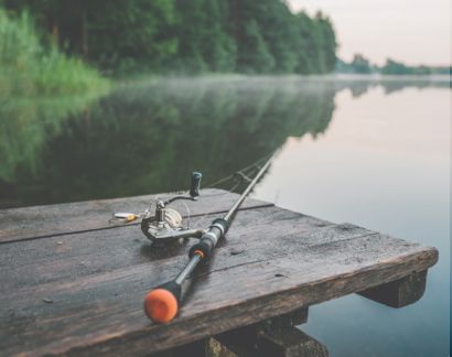
Fishing: Cast your line at Big Lake, Willow Springs Lake, or the Black River for trout and bass. Willow Springs Lake offers ice fishing during winter months. Check ice conditions before fishing, and ensure you have an Arizona State fishing license.
Boating :Enjoy motorized and non-motorized boating at scenic spots like Luna Lake Recreation Area, Willow Springs Lake, Fool Hollow Lake, and Big Lake.
Hiking : The Apache-Sitgreaves National Forests offer nearly 1,000 miles of trails for all skill levels, including four National Recreation Trails and sections of the White Mountain Trail System. Trails range from desert paths to high-elevation routes.
Horse Riding: Apache-Sitgreaves National Forests provide excellent horse riding opportunities with trails like Bear Wallow Trail (#63), Escudilla National Recreation Trail (#308), and Luna Lake Bike Trailhead. Many trails feature corrals and horse troughs for convenience.
Stargazing : With minimal light pollution, the forest is a hotspot for night-sky observation, particularly near Mogollon Rim.
Birdwatching :Spot diverse bird species, including Bald Eagles, Mexican Spotted Owls, and Northern Goshawks.
-
Nature Watching

The Apache-Sitgreaves National Forest is home to many different plant and wildlife species. Hannagan Meadow, the Escudilla Wilderness, and the Bear Wallow Wilderness are great places to see the scenery and the local critters.
-
Water Sports

When the weather is warm, rent a boat and head to Luna Lake, Willow Springs Lake, Fool Hollow Lake, and Scott Reservoir. Hop on the Blue River Trail to Hannah Hot Springs for a fun wilderness dip; you can also swim in the cool pool nearby. For kayaking and canoeing, check out Black Canyon Lake, Woods Canyon Lake, and the many reservoirs in the forest.
-
Winter Sports

In the winter, try ice fishing, snowshoeing, cross-country skiing, and snowmobiling. If you have little ones, check out the Toboggan Hill sledding area in the Williams Valley Recreation Area.
-
Geocaching

Geocachers will enjoy plenty of fun hunts in this diverse ecosystem.
How to get to Apache-Sitgreaves National Forest
Address: 30 S. Chiricahua Dr., Springerville, AZ 85938
Fee: Entry Fee
Reaching Apache-Sitgreaves National Forests by car and air is very convenient and easy.
By Car
From Phoenix: Take I-10 E to AZ-87 N, then continue to AZ-260 E in Coconino County. The journey to Apache-Sitgreaves National Forests headquarters in Springerville covers 119 miles and takes about two hours and 3 minutes.
From Flagstaff : Take I-40 E via Historic Route 66 and E Butler Ave, then exit at Hipkoe Dr in Winslow. Continue on AZ-99 E to Apache-Sitgreaves National Forests headquarters in Springerville. The journey is approximately 89 miles and takes about one hour and 30 minutes.
From Albuquerque, NM: Take I-40 W for 68.5 miles and exit at NM-117 E (Exit 89). Follow NM-117 E for 78.3 miles into Catron County. Continue on US-60 W for 50.8 miles to US-180 E/US-191 S in Apache County. The journey is approximately 200 miles and takes about three hours and 14 minutes.
By Air
Phoenix Sky Harbor International Airport (PHX): Phoenix Sky Harbor International Airport is approximately three hours and 45 minutes (219 miles) from the Apache-Sitgreaves National Forest via AZ-87 N and AZ-260 E.
Springerville Municipal Airport (KJTC): Just 10 minutes (5.3 miles) away, it is the closest and most convenient airport for accessing Apache-Sitgreaves National Forest.
Seasonal Restrictions
Due to snow, some roads and trails may be closed in winter. Check with the forest service for updates.
Fees and Alerts
Entry Fees: Entry to Apache-Sitgreaves National Forest is free, but many campgrounds charge a fee.
Permits : Required for wood collection and certain commercial activities.
Frequently Asked Questions About Apache-Sitgreaves National Forest
Can you kayak, canoe, or raft in Apache-Sitgreaves National Forest?
Yes, you can kayak and canoe in Apache Sitgreaves National Forest. Sunrise Lake is a great spot for kayaking and canoeing, as is Woods Canyon Lake, along with several others.
What is the closest town to Apache-Sitgreaves National Forest?
Greer, Arizona is the closest town to Apache Sitgreaves National Forest. Alpine is also a nearby town with plenty of places to stay and other amenities.
Is there a fee to get into Apache-Sitgreaves National Forest?
There is not a fee for most areas or activities in the Apache Sitgreaves National Forest. However, there are fees for campgrounds, cabin rentals, and a few other amenities.
What type of wildlife lives in Apache-Sitgreaves National Forest?
Wildlife at Apache Sitgreaves National Forest includes antelope, elk, bighorn sheep, turkey, and a variety of birds and fish.
How many hiking trails does Apache-Sitgreaves National Forest have?
There are almost 1,000 miles of hiking trails in the Apache Sitgreaves National Forest. There are four National Recreation Trails - Eagle, Blue Ridge, Escudilla, and General George Cook, along with many other trails.
.png)