Modoc National Forest Guide
- Home
- National Forests
- California
- Modoc National Forest
Modoc National Forest is located in the northeastern corner of California. It offers a stunning landscape of volcanic Cascades, the scenic Warner Mountains, and expansive plateaus. With over 1.5 million acres of wilderness, visitors can explore forests, wildlife-rich areas, and volcanic lava flows. For RVers, Soup Springs Campground offers access to the South Warner Wilderness, with nearby equestrian trails. Willow Creek Campground, a hidden gem with eight sites, is perfect for small trailers and motorhomes. It offers shady sites, vault toilets, and piped water. Howard’s Gulch Campground provides interpretive sites, picnic tables, and drinking water, making it ideal for a comfortable stay while exploring the forest. RVs can be rented from RV Share for areas like Jackson, Hattiesburg, and Biloxi.
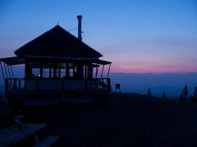
Camping in Modoc National Forest
Modoc National Forest RV camping offers a range of options, from developed campgrounds to remote, dispersed sites.
Campgrounds in Modoc National Forest
$15 per day
$15 per day
$15 per day
$15 per day
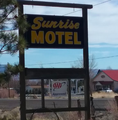
Private Campgrounds Near Modoc National Forest
Before planning your trip to the forest, check out the top campgrounds in California. When camping near Modoc National Forest, you can also look for campgrounds in cities like Redding or Sacramento.
For convenient RV waste disposal at campgrounds near Modoc National Forest, check out these dump stations. You can also explore popular BLM locations in California.
Campgrounds by Lakes/Rivers for Fishing and Water Activities
No fee
$15 per night
No fee
$10 per night
Budget-friendly Campgrounds
No fee
No fee
No fee
RV Rentals Near Modoc National Forest
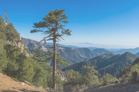
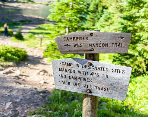
Modoc National Forest Hiking Trails
Explore Modoc National Forest's vast network of hiking trails, ranging from easy scenic walks to more challenging backcountry hikes.
Easy Trails
Distance: 6.6 Miles
Difficulty: Easy
Distance: 0.9 Miles
Difficulty: Easy
Distance: 2.9 Miles
Difficulty: Easy
Challenging Trails for Hikers
Distance: 6.4 Miles
Difficulty: Moderate
Distance: 5.1 Miles
Difficulty: Moderate
Distance: 14.5 Miles
Difficulty: Difficult
Distance: 7.1 Miles
Difficulty: Difficult
Lakeside Trails
Distance: 1.8 Miles
Difficulty: Easy
Distance: 5.3 Miles
Difficulty: Difficult
Distance: 13.3 Miles
Difficulty: Difficult
-
Glass Mountain Trail
The Glass Mountain Trail is an in-and-out pathway that offers scenic views while changing elevation by 1,053 feet. Pines tower over an immense amount of obsidian that dots the trail—hence the name Glass Mountain. At the peak of the grade, visitors enjoy an intense panoramic view of the surrounding countryside.
Length: 4.9 miles
Intensity: Intermediate
-
Medicine Lake Volcano, Mount Hoffman-Standard Summit Route
Most people wait until the winter months to use this trail. In the summer, the trek seems long, but it is reduced significantly in the winter by the opportunity to use skis when traveling back down the mountain, saving considerable time. The view of Medicine Lake from the summit of the mountain is worth the trip.
Length: 13.3 miles
Intensity: Difficult
-
Modoc Line Rail Trail
Though the Modoc Line Rail Trail is long, it is an easy hike that is relatively level with gentle grades up and down. The trail wanders through some of the most breathtaking rangeland in northeastern California. Visitors can expect to see many wildlife species, including pronghorn antelope. The views from the summit of the Skedaddle and Warner mountain ranges are spectacular.
Length: 84.7 miles
Intensity: Easy to Intermediate
-
Crane Mountain National Recreation Trail #161
The Crane Mountain National Recreation Trail begins in Modoc National Forest and travels almost due north into Oregon. Throughout the hike, the pathway offers views of Goose Lake Valley, which shares a lake on both sides of the California-Oregon border. The highest point is at 8,347 feet on the summit of Crane Mountain, which contributes views of Mount Shasta to the west and the high desert to the east.
Length: 37.5 miles
Intensity: Hard
-
Cedar Creek Trail
The Cedar Creek Trail offers two trailheads that provide different levels of intensity over the same pathway. The upper trailhead leads to a leisurely downhill hike that drops by 790 feet over a three-mile course. The lower trailhead covers the same ground, but the uphill climb is more strenuous. During the winter months, the upper trailhead offers an excellent snowboarding experience.
Length: 3 miles
Intensity: Easy to Intermediate
Activities in Modoc National Forest
Here are some popular activities and things to do in Modoc National Forest.
OHV Riding: Modoc National Forest is a top destination for OHV enthusiasts. With over 3,600 miles of rugged, low-maintenance roads open to OHV use, plenty of opportunities exist for off-road adventures. Trails are marked, and the forest offers a unique landscape for riders to explore.
Wildlife Viewing: The forest is home to over 300 wildlife species, including elk, pronghorn antelope, and wild horses. The Pacific Flyway passes through it, making it a prime location for birdwatching during migration season.
Fishing: Modoc National Forest offers fantastic fishing opportunities in lakes and rivers. Anglers can fish in one of the many water bodies in the forest depending on seasons set by the California Department of Fish and Game.
Horse Riding: Camping in Modoc National Forest offers excellent opportunities for horseback riding. Popular areas like the Warner Mountains and the South Warner Wilderness are perfect for late summer and fall rides, offering scenic views and a peaceful environment. In spring and early summer, Devil's Garden and Big Valley Districts provide lower-elevation options free of snow and mud.

-
Identifying Flora and Fauna

The Modoc National Forest offers a mix of plant growth, primarily because of its incredibly diversified terrain. The lower levels support bitterbrush and curl-leaf mahogany. As you climb higher, these plants give way to white and red firs, ponderosa pine, incense cedar, and aspen. Near the mountain summits, lodgepole and western white pines dominate the terrain.
The animal life in the Modoc National Forest is native to the area, thanks mainly to establishing the forest before developers moved in. Pronghorn antelope populate the region along with a small population of mountain goats. Hawks, eagles, and other birds of prey hunt the collection of small rodents that cover the valley floors.
-
Fishing

Fishing is one of the many activities that visitors enjoy in the Modoc National Forest. With hundreds of streams and over 30 lakes and ponds, the forest greets anglers with stocked fish at almost every turn. The elusive trout is the favorite fish to pursue in these parts.
-
Geocaching

Geocaching is allowed in the Modoc National Forest, but regulations are strict because of the environment's fragility. Caches must be located within 30 feet of an established trail, and you must apply for permission to establish your cache.
-
Stargazing

There is little light pollution, with the nearest community being 30 miles away and the high elevations that the Modoc National Forest occupies. The skies offer some of the best stargazing in the country. At almost any location inside this forest, the night sky provides a spectacular display.
How to get to Modoc National Forest
Address: 225 West 8th Street, Alturas, CA 96101
Fee: Entry fee $0
By Car
Highway 395: Take Highway 395 north from Alturas to Modoc National Forest.
Highway 161: Drive east along Highway 161 from Tulelake to directly access the forest’s southern areas.
By Air
Alturas Municipal Airport (ALY): Located about 10 miles from the forest, this airport has limited regional flight options.
Klamath Falls Airport (LMT): 70 miles away, this airport offers commercial flights that connect to major cities.
Seasonal Restrictions
Check for seasonal restrictions on certain trails and campgrounds, especially during winter and spring. Before your trip, check the Alerts & Closures page for any closures or restrictions.
Fees in Modoc National Forest
There is no general entry fee for Modoc National Forest. However, certain activities, like camping or OHV use, may have associated costs. Be sure to check for specific fees at your chosen location when looking for campgrounds near Modoc National Forest.
Frequently Asked Questions About Modoc National Forest
Does Modoc National Forest offer free camping sites?
Yes, Modoc National Forest has free camping sites. There is dispersed camping in the forest, and there are several developed campgrounds that do not charge a fee as well.
Do you need a permit to fish or hunt in Modoc National Forest?
Yes, you need a permit to hunt in Modoc National Forest. Anyone age 16 and above needs a fishing license to fish in California as well.
Is Modoc National Forest open all year round?
Yes, Modoc National Forest is open year-round. However, some areas get a lot of snow and are not plowed in winter. There may be certain regions of the forest that are inaccessible or activities that can't be done during certain months.
Can you kayak, canoe, or raft in Modoc National Forest?
Yes, you can kayak and canoe in Modoc National Forest. Lily Lake, Medicine Lake, and various other lakes are great spots for paddling.
What type of wildlife lives in Modoc National Forest?
Wildlife including bald eagles, mule deer, coyotes, skunks, muskrats, and black-tailed jackrabbits all live in the Modoc National Forest. There is also a variety of birds and fish that live in the forest as well.