
Chattanooga, Tennessee Top Pet Friendly RV Parks and Campgrounds
Whitewater RV Park

Raccoon Mountain Caverns & Campground
Raccoon Mountain Caverns & Campground offers family attractions and wild cave expeditions to campers. These family attractions may include go-karts, Raccoon Mountain cave tours, access to an outdoor saltwater pool, a playground, a swinging bridge, hiking trails, and ladderball. Any pet visiting the campground will enjoy the enclosed bark park available on the premises.
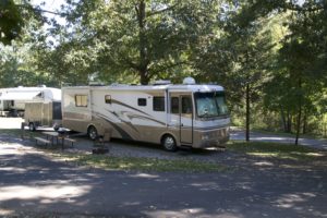
Sweetwater / I-75 / Exit 62 KOA
Sweetwater / I-75 / Exit 62 KOA is minutes away from Lost Sea, Mayfield Dairy Farms, Sweetwater Valley Cheese Farm, Sweetwater’s Antique District, and the Cherokee tiol Forest. Your entire family can enjoy a game of Water Wars. Sweetwater KOA is one of those campgrounds near Chattanooga, Tennessee, that features a catch-and-release pond stocked with catfish, bluegill, and bass.
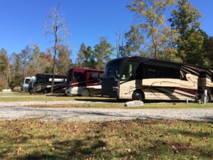
Chattanooga North / Cleveland KOA
Chattanooga North / Cleveland KOA is close to many attractions in the surrounding counties. It is located in the rolling hills between the Appalachians and the Cumberland Plateau. This campground is also near the Ococee River, which is one of the most impressive whitewater rivers in the nation.

Camping World of Chattanooga
Camping World of Chattanooga is located in the back of the Camping World store. Campers have to visit the Camping World store to register for one of their Chattanooga campsites. This campground is a self-serve type park, which means spots are available on a first come, first serve basis.
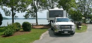
Chester Frost Park Campground
Chester Frost Park Campground is located on Lake Chickamauga Lake, which is one of Tennessee’s biggest lakes. This trailer park near Chattanooga, Tennessee, gives campers access to a powerboat launch, a swimming beach, boat docks, ramps and fishing piers. This campground also holds competitive events, including the annual Hamilton County Fair and fishing tournaments.
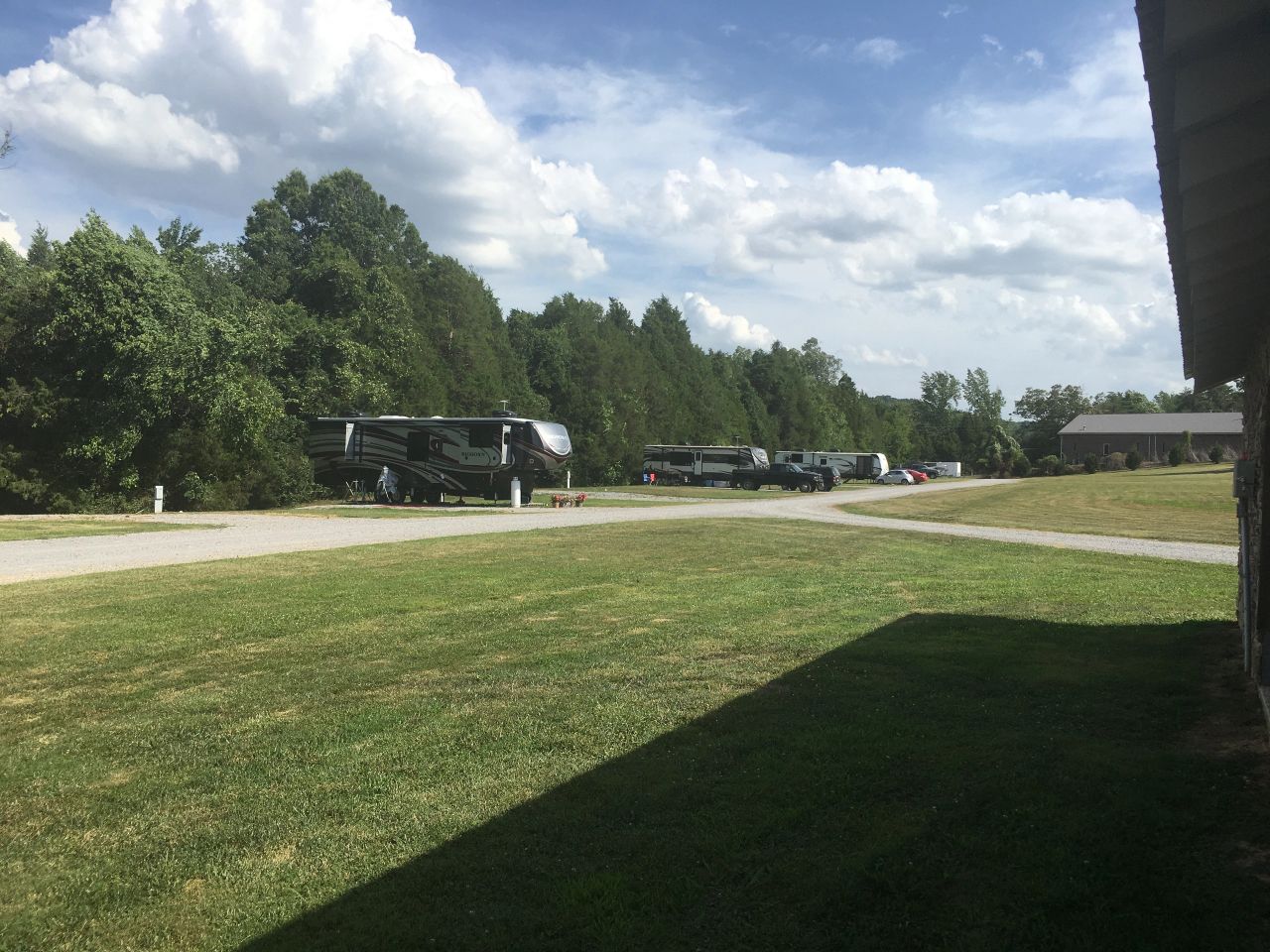
Cedar Point RV Park
Long-Term RV Park – Peaceful, Quiet & Beautiful Escape the hustle and bustle and settle into our serene, long-term RV park, where tranquility and natural beauty surround you. Nestled in a peaceful setting, our park offers spacious, well-maintained sites perfect for extended stays. Enjoy the gentle rustle of trees, stunning sunsets, and a relaxed atmosphere that feels like a retreat.
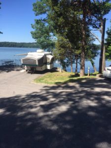
Harrison Bay State Park
Harrison Bay State Park expands across 1,200 acres. It is also made up of 40 miles of Chickamauga Lake shoreline. This campground is covered with trees, which is a haven for fishermen, picnickers, campers, boaters, and golfers.
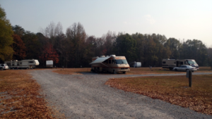
Bitner’s RV Park
Bitner’s RV Park is located near many of the attractions in the surrounding counties. It is minutes away from Dollywood, Knoxville, The Great Smoky Mountain National Forest, Chattanooga, Rock City, Watts Bar Lake, and Lake Chickamauga. This campground also has an on-site convenience store.
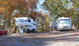
Deer Ridge RV Park
Deer Ridge RV Park is located in Georgetown, Tennessee, near the Hiwassee River. Campsites are shaded with gravel pads. This campground also caters to children by providing a grassy area with swings on the property.
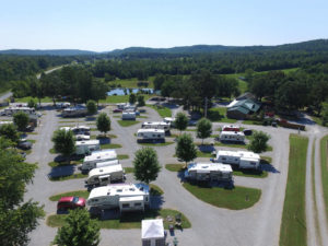
Mountain Glen RV Park & Campground
Mountain Glen RV Park & Campground is located on the scenic Cumberland Plateau. Campers can expect to see and do a variety of activities when visiting this campground. These may include cave tours, breathtaking waterfalls, golf courses, hiking trails, and scenic train rides.

Outpost RV at Camp Chet
Camp Chet is dedicated to providing the setting for an amazing camping experience for anyone looking for immersion into lush Tennessee forest. We have several camp areas and many miles of marked hiking and mountain biking trails on over 900 acres of the Cumberland Plateau just north of Chattanooga TN and 2 hours south of Nashville and Knoxville.
Stay Wilder Campground - Rising Fawn, GA

Pocket Picnic Shelter
Overview Pocket Picnic Shelter is a reservable shelter in the Pocket Recreation Area located in Armuchee, Ga. The shelter is a great location to hold family get togethers, birthday parties, work luncheons, retirement parties, or any other celebration one can think of. The Pocket Recreation Area is located within the Chattahoochee-Oconee National Forest in the ridges and valleys of northwest Georgia. The shelter sits in a low lying geographical area between Horn and Mill mountains. This low lying area was formed by limestone dissolving, leaving the ridges above and valleys below. These ridges are rich in iron ore "pockets" giving this area its name. Deer and turkeys thrive in the surrounding forest. Spring wildflowers and autumn colors abound, showcasing the beauty of the region. Nearby trails and overlooks allow visitors to enjoy the National Forest from different perspectives. The Pocket area is rich in cultural and historical history. In the mid-1800s until the Great Depression in the 1930s, this area consisted of two communities, Pocket and Zone. These communities consisted of farms, churches, home places, a grist mill, a saw mill, and a general store. Between 1938 and 1942, the Pocket Recreation Area was the site of a thriving Civilian Conservation Corps (CCC) work camp for Company 3435. The men of the CCC, under the guidance of the U.S. Forest Service, had a tremendous impact on the area. They were involved in building roads, bridges, erosion control, tree planting, and the construction of recreation sites. The CCC played an instrumental part in helping local farmers with erosion control and road maintenance. Remnants of the camp can be found throughout the Pocket Recreation Area. These remnants include foundations for buildings, drainange trenches, and the retaining walls and spring box in the picnic area. Activities in the Pocket Recreation Area include camping, picnicking, hiking, and trout fishing in nearby Johns Creek. Recreation The Pocket Picnic Shelter is located in the Pocket Picnic Area, part of the Pocket Recreation Area. The Pocket Recreation Area consists of the picnic shelter, a picnic area, and a campground. Camping, picnicking, hiking, birding, and wildflower viewing are all popular activities in the area. The trail heads for the Pocket Loop Trail and Pocket Interpretive Trail are located in the picnic area. A Civilian Conservation Corps spring box is located in the creek, releasing cold water from deep below the surface. This is a great place to wade and cool off during long summer days. Hiking the 1.5 mile Pocket Interpretive Trail contains signs to provide an educational walk through multiple types of habitat where an array of wildlife and plant species can be found. The 2.5 mile Pocket Loop Trail provides a similar, but longer experience, sharing some of the same tread with the interpretive trail. Visitors also enjoy the 3.5-mile Pocket Foot Trail that loops between the picnic area and a nearby campground. Interpretive signs are placed along the route, including a brief description of the area. It is a relatively wide path and a nice, easy walk. Trout fishing in Johns Creek (less than a mile away) is a great place to wet a line and fill one's creel. Georgia DNR fishing regulations apply. The Pocket Campground is adjacent to the picnic area. Information on the Pocket Campground can be found here: Pocket Campground More information about the Chattahoochee-Oconee National Forest and other recreational activities can be found here: Chattahoochee-Oconee National Forest Facilities The Pocket Picnic Shelter is located in the Pocket Picnic Area, part of the Pocket Recreation Area. The Pocket Recreation Area consists of the picnic shelter, a picnic area, and a campground. Camping, picnicking, hiking, birding, and wildflower viewing are all popular activities in the area. The trail heads for the Pocket Loop Trail and Pocket Interpretive Trail are located in the picnic area. A Civilian Conservation Corps spring box is located in the creek, releasing cold water from deep below the surface. This is a great place to wade and cool off during long summer days. Hiking the 1.5 mile Pocket Interpretive Trail contains signs to provide an educational walk through multiple types of habitat where an array of wildlife and plant species can be found. The 2.5 mile Pocket Loop Trail provides a similar, but longer experience, sharing some of the same tread with the interpretive trail. Visitors also enjoy the 3.5-mile Pocket Foot Trail that loops between the picnic area and a nearby campground. Interpretive signs are placed along the route, including a brief description of the area. It is a relatively wide path and a nice, easy walk. Trout fishing in Johns Creek (less than a mile away) is a great place to wet a line and fill one's creel. Georgia DNR fishing regulations apply. The Pocket Campground is adjacent to the picnic area. Information on the Pocket Campground can be found here: Pocket Campground More information about the Chattahoochee-Oconee National Forest and other recreational activities can be found here: Chattahoochee-Oconee National Forest Natural Features The Pocket Picnic Shelter is located off the Ridge and Valley Scenic Byway in northwest, Ga. Surrounded by the horseshoe ridges formed by Horn and Mill Mountains, the Pocket is located in a geographical region known as the Ridge and Valley Province of Northwest Georgia, part of the Southern Appalachian Mountains. This region consists of long narrow ridges, sweeping valleys, creeks, streams, ponds, and waterfalls. A small creek, locally known as Spring Branch (a tributary to nearby Johns Creek) meanders through the recreation area, providing a cool relief in the summer months. An informational interpretive loop trail and the Pocket Loop Trail leads visitors through a mixed pine/oak forest, past a small wildlife pond, and near wildlife food plots. This variety of natural features provides habitat for deer, turkeys, a multitude of song birds, and aquatic life, such as amphibians and beavers. The Johns Mountain Overlook and the Keown Falls Picnic Area are found nearby. These two beautiful recreation sites showcase the natural features of the surrounding region. Nearby Attractions Johns Creek Trout Fishing Area: A great place to go trout fishing managed by the U.S. Forest Service and GA DNR with the help of Trout Unlimited. Leaving the campground, turn left onto Pocket Road. After 1/4 mile stay right at the Y. After 1 mile look for legal pull-offs for fishing access. (Georgia DNR fishing regulations apply). Johns Mountain Overlook: A U.S. Forest Service overlook where visitors can view the Armuchee Valley and distant Taylor's Ridge. Leaving the campground, turn right onto Pocket Road. After 3 miles turn left at the Johns Mountain Overlook entrance sign (Forest Service Road 208). Follow FSR 208 for 2 miles to the overlook. Keown Falls Picnic Area and Trailhead: A beautiful place to picnic with a loop hike to Keown Falls. Best seen after rain. Leaving the campground, turn right onto Pocket Road. After 2 miles turn left at the Keown Falls Trailhead entrance sign (Forest Service Road 702). Follow FSR 702 for half a mile. The Keown Falls trail is a 3 mile loop trail. The falls are about 1 miles when following the trail counter clockwise. Chestnut Mountain Shooting Range (Fee Area, see Recreation.gov page Chestnut Mountain Shooting Range ): A U.S. Forest Service shooting range to hone your shooting skills. You must provide your own firearm, ammunition, and targets. Leaving the campground, turn right onto Pocket Road. After 4.6 miles turn right onto Furnace Creek Road. After 2 miles on Furnace Creek Road, turn right onto GA-136. Follow GA-136 for 5.7 miles. Turn left at the Chestnut Mountain Shooting Range entrance sign (Forest Service Road 212). Follow FSR 212 for a half mile. Houston Valley OHV Area (Fee Area, see Recreation.gov page Houston Valley OHV Area ): A U.S. Forest Service ATV trail system. This is a designated area with 25 miles of various levels of trails where visitors can legally ride dirt bikes and ATVs (under 50 inches). On the Chattahoochee-Oconee National Forest ATVs and dirt bikes are limited to designated OHV trails and not allowed to be driven on roads designated as Forest Service Roads (National Forest Roads ARE NOT part of the county road system). Visitors must provide their own vehicles at this facility. Leaving the campground, turn right onto Pocket Road. Follow Pocket Road for 7.3 miles then turn left onto GA-136. After 1/10th of a mile turn right onto GA-201. Follow GA-201 for approximately 5.5 miles and veer left onto Old Ringgold Road. After approximately 5 miles turn left onto Houston Valley Road. After 2 miles turn onto Capehart Road. Follow Capehart Road into the Houston Valley OHV parking lot. The closest town is Dalton, Georgia, which is about 25 miles east of the picnic area. Dalton has numerous grocery stores, restaurants and gas stations available.
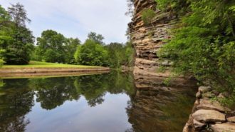
Fall Creek Falls State Park
Fall Creek Falls State Park is the place to go for a camping trip that will let you experience the wild beauty of Tennessee. As the largest state park, Fall Creek Falls encompasses over 26,000 acres across the Cumberland Plateau. Waterfalls, streams, cascades, and lush forests make this a picturesque park- the perfect place for families to come together and experience the serene landscapes of Tennessee.

DeSoto Resort State Park
DeSoto State Park is one of the more well-known RV parks in Gadsden and one of the foremost campgrounds in the Southern United States. There is no doubt, then, that it would provide a fantastic RV experience in a wooded, mountainous setting.

Chilhowee Campground
Overview Located in the Chilhowee Recreation Area, Chilhowee Campground offers a multitude of camping opportunities for both RV and tent sites, many with electric hookups. The day-use area includes McKamy Lake, a swim area with sand beach, picnic sites, a group picnic area, and a bathhouse. Be Aware; Do not use GPS directions: GPS coordinates will direct you up Benton Springs Rd. This route is not recommended. We recommend using Forest Service Road 77 to reach the recreation area. It's important to note, this facility requires driving 7 miles up to Chilhowee Campground on a narrow, winding road. Do not use the Benton Springs Access Road to the campground as this is an unpaved and dangerous road for RVs. Inexperienced RV drivers may have difficulties getting to and around the site. Recreation Chilhowee Recreation Area is an excellent hub for hiking and mountain biking in the Chilhowee Trails System, fishing in McKamy Lake, and wildlife viewing without having to get in your car. The 7-acre McKamy Lake offers a swim area with a sand beach, and fishing from the bank. Boats are allowed, but gasoline motors are not. Within the recreation area are approximately 25 miles of hiking and biking trails, and a scenic waterfall. The views and lake are beautiful, especially hiking to Benton Falls via a 1.5 mile in and out moderate trail. On the drive up to the campground, stop at one of the many observation overlooks to see beautiful mountain settings. Wildlife is abundant in this area, so have your camera ready and tread lightly. Chilhowee Recreation Area Map and Guide Facilities Chilhowee Recreation Area is an excellent hub for hiking and mountain biking in the Chilhowee Trails System, fishing in McKamy Lake, and wildlife viewing without having to get in your car. The 7-acre McKamy Lake offers a swim area with a sand beach, and fishing from the bank. Boats are allowed, but gasoline motors are not. Within the recreation area are approximately 25 miles of hiking and biking trails, and a scenic waterfall. The views and lake are beautiful, especially hiking to Benton Falls via a 1.5 mile in and out moderate trail. On the drive up to the campground, stop at one of the many observation overlooks to see beautiful mountain settings. Wildlife is abundant in this area, so have your camera ready and tread lightly. Chilhowee Recreation Area Map and Guide Natural Features The Cherokee National Forest is located in eastern Tennessee and stretches from Chattanooga to Bristol along the North Carolina border. The 650,000-acre swath of land is Tennessee's only national forest. It lies in the heart of the Southern Appalachians and is home to more than 20,000 species of plants and animals, as well as many rivers, creeks and lakes. Nearby Attractions In addition to the immediate local activities, world class whitewater rafting opportunities are nearby on the Ocoee and Hiwassee Rivers.

Parksville Lake Rv Campground
Overview Located near Parksville Lake, Parksville Lake RV Campground offers well-shaded and nicely spaced campsites accommodating larger RVs. Several sites offer the opportunity for two RVs to camp close together and several are located along a small stream. Recreation Parksville Lake RV Campground is central location for day trips to the many inviting outdoor recreation opportunities in the area. Visitors to nearby Parksville Lake will enjoy beaches for swimming and boat ramps for water access. The area boasts many miles of mountain bike and hiking trails. Whitewater rafting enthusiasts will want to check out the Ocoee Whitewater Center. Facilities Parksville Lake RV Campground is central location for day trips to the many inviting outdoor recreation opportunities in the area. Visitors to nearby Parksville Lake will enjoy beaches for swimming and boat ramps for water access. The area boasts many miles of mountain bike and hiking trails. Whitewater rafting enthusiasts will want to check out the Ocoee Whitewater Center. Natural Features The Cherokee National Forest is located in eastern Tennessee and stretches from Chattanooga to Bristol along the North Carolina border. The 650,000-acre swath of land is Tennessee's only national forest. It lies in the heart of the Southern Appalachians and is home to more than 20,000 species of plants and animals, as well as many rivers, creeks and lakes. Nearby Attractions The campground is conveniently located near the Ocoee River and the Ocoee Whitewater Center (site of the 1996 Olympic Kayak events).

