In the Lower 48, Washington is the smallest western state. And yet, it’s one of biggest in all of America when it comes to geographic and cultural diversity. To the west, the Evergreen State lives up to its nickname with rainforests, volcanic peaks, islands, ocean beaches and beautiful, cosmopolitan Seattle. The Cascade Range sucks the moisture out of the clouds, making the central and eastern parts of the state an arid mix of desert, farmland and ponderosa pine forests. Fruit orchards and vineyards run north to south through the state’s midsection while the rolling hills of the southeast change from green to gold and brown as crops mature and harvest finishes. Around Spokane and the northeast, the feel is distinctly intermountain west with pine forests, bright sunshine and snowy winters. Washington’s byways mirror the state’s variety and thus, you won’t find a collection of drives more different anywhere in the U.S. Here are our favorites.
- Cascade Loop includes:
- Whidbey Island Scenic Isleway
- North Cascades Scenic Byway
- Stevens Pass Greenway – National Scenic Byway
- Olympic Peninsula includes:
- Strait of Juan de Fuca Highway – National Scenic Byway
- Cape Flattery Tribal Scenic Byway
- Magnificent Mount Rainier includes:
- Chinook Scenic Byway – All-American Road
- White Pass Scenic Byway – National Scenic Byway
- Coulee Corridor Scenic Byway – National Scenic Byway
- Palouse Scenic Byway
Cascade Loop
460 miles, from Everett to Whidbey Island to La Conner to North Cascades National Park to Winthrop to Chelan to Wenatchee to Leavenworth and back to Everett
This road trip is actually made up of three byways that run north through an island, then east through agricultural fields and across the North Cascades, then south past fruit orchards and vineyards lining the Columbia River before returning west through the mountains. If you only have time for one Washington road trip, this is the most comprehensive, as you’ll see from this itinerary’s length. Keep in mind that two of the Cascade Loop’s premier attractions are seasonal and don’t happen at the same time. To the north, Skagit Valley’s unbelievable tulip fields bloom in April but that’s also when the highway to the east through North Cascades National Park is usually still closed for winter. It reopens in spring after the snow has been plowed and sometimes that’s as early as late April, and so if you’re lucky you might be able to see the flowers, drive all the way through the national park and complete the full Cascade Loop.
Start the journey in Everett, a small city 30 miles north of Seattle with the largest public marina on the West Coast and an authentic 1890s marina marketplace. Everett has an attractive historic downtown, and if you’re into aviation, Boeing builds some of the world’s biggest airplanes nearby. On the Boeing Tour you can see jets being assembled and visit the Future of Flight Aviation Center.
From Everett, it’s seven miles west to Mukilteo for a quick ferry ride to Whidbey Island and the start of the Whidbey Island Scenic Isleway. Washington has some 180 islands and Whidbey is one of the easiest to reach and explore. Plus, from the southside it only requires one ferry ride as the island is connected to the mainland by a bridge on the north end. When the ferry arrives in Clinton, follow State Highway 525 west about 2.5 miles and then go north on Langley Road for three miles to the town of Langley. One of the two main tourist centers on the island, the quaint village has a few shops and restaurants. To learn about orcas, gray whales, humpbacks and other marine mammals, drop by the Langley Whale Center with exhibits, a library and gift shop.
From Langley, it’s about 14 miles west to South Whidbey State Park. Use GPS as there are a couple of different ways to get there. There’s no camping at this day park but it offers views of Admiralty Inlet as well as hiking through an old-growth forest of Douglas fir, Sitka spruce, western hemlock and western red cedar, including one giant that’s more than 500 years old.
From the park, go five miles north to Greenbank Farm, an historic property saved from developers and preserved by the local community that now features a café and shops specializing in art, cheese and wine. The farm once grew loganberries and so the stores source the hybrid blackberry/raspberry for pies and wine. Outside, there’s a demonstration garden and miles of walking trails with water and mountain views.
From Greenbank Farm, it’s another 11 miles north to the island’s other charming town, Coupeville, with shops and restaurants lining the shore. A highlight is walking over water on the Coupeville Wharf & Public Dock where low tide reveals barnacles, sea stars and all kinds of shells. Coupeville lies on Penn Cove, which is known for its mussels, a specialty in many Whidbey Island restaurants, along with local clams and oysters.
An old military fort that’s now known for coastal camping is the next destination, six miles from Coupeville on the western side of the island. Fort Ebey State Park offers hiking, swimming, kayaking and paddleboarding. You’ll need a license to gather shellfish and seaweed. Kelp harvesting is allowed from mid-April to mid-May.
Another nine miles north of Fort Ebey is Oak Harbor, the island’s largest town with grocery stores, seafood restaurants and a golf course. Nearby is Naval Air Station Whidbey Island, which can be a noisy neighbor at times when aircraft conduct day and night training missions.
The next state park is one of Washington’s most visited. Ten miles north of Oak Harbor, Deception Pass lies on both Whidbey and Fidalgo islands, connected via Pass Island by two oft-photographed steel bridges. The “pass” is the narrow inlet between islands which powerfully churns as tides move in and out. The park has campsites and beach access, but most people come for the signature, jaw-dropping views from the high cliffs. You can walk across the bridges and hike trails through old-growth forests. Fresh- and saltwater fishing and crabbing are popular as well as guided boat tours through the pass.
From Deception Pass it’s another ten miles north to Anacortes, a large town with a ferry terminal and passage to the San Juan Islands. But the Cascade Loop actually follows Highway 20 east. So, from the state park, go 5.5 miles north to Sharpes Corner. Instead of going left to Anacortes, take a right toward Mount Vernon. For a scenic detour, in about two miles turn right onto Reservation Road and then it’s seven miles through the Swinomish Reservation to La Conner. As you reach town, you’ll cross over the Swinomish Channel which separates Fidalgo Island from the mainland. With the Swinomish Indian Tribal Community to the west, the Cascade Mountains in the distant east, farmland in all directions and a small marina with access to the Puget Sound, La Conner is a fascinating blend of history and pastoral beauty. The downtown has many shops, a brewery, restaurants, lodging and the Museum of Northwest Art which sets a regional mood through photos, paintings and sculptures. In April the town is particularly busy as the area’s tulip fields are ablaze in color during the month-long Skagit Valley Tulip Festival. Running about 12 miles from La Conner to Mount Vernon, the Tulip Route travels to four of the area’s main tulip farms which you can tour for a fee. The massive plantings rival the world’s best and often include other bulbs like daffodils and hyacinths. Be sure to monitor weather conditions several weeks in advance as peak bloom shifts every year. If possible, drive the Tulip Route on early weekdays when it’s less crowded. Arriving in Mount Vernon, you’ll notice it’s much larger than La Conner with many options for fuel, food and camping. Two must-stops include Forté Chocolate, an internationally acclaimed confectionary, and throughout April during the tulip festival, the Kiwanis Club of Mount Vernon barbecues wild salmon at Hillcrest Park on Fridays, Saturdays and Sundays.
From Mount Vernon, head north 3.5 miles on I-5 to Burlington and then go east on Highway 20. You’re now on the North Cascades Scenic Byway which runs through North Cascades National Park. However, as mentioned earlier, the road closes for the winter and reopens in April or early May. That said, you can still drive a good distance into the park before reaching the dead end, and the scenery is worth it year-round. From Burlington, the byway follows the Skagit River through several small towns as the jagged Cascade Range closes in on all sides. About 36 miles from Burlington, Rockport State Park sits to the left, at the foot of Sauk Mountain. Though there’s no camping, the park is a good place for a picnic or a short hike while admiring the large, protected stand of 300-year-old, 250-foot tall Douglas firs.
From the state park, Highway 20 climbs higher and deeper into the mountains 23 miles before reaching North Cascades National Park and the visitor center with exhibits, information and restrooms. There are also campgrounds and hiking trails. One of the most beautiful and lesser visited national parks, the byway has numerous overlooks and access areas for camping and hiking. It also intersects two major trails: the 1,200-mile Pacific Northwest National Scenic Trail which runs east to west from the Continental Divide in Montana to the Pacific Ocean. The longer and better known 2,650-mile Pacific Crest National Scenic Trail runs north to south from Canada to Mexico. Aside from outstanding alpine scenery with lakes, waterfalls and abundant birds and mammals, the national park has more than 1,600 species of plants. Starting in the temperate rainforest of the west, the byway climbs over the moisture-sucking mountains and into the dry ponderosa pine ecosystem of the east. In winter, the highway is closed 15 miles east of the visitor center at the Ross Dam Trailhead. The rest of the year, continue on, making sure to stop at the Washington Pass Overlook, the highest point along the byway, 43 miles from the visitor center. Then, the drive makes a dramatic descent, passing through Mazama where the winter road closure happens on the eastern end.
From the Washington Pass Overlook, it’s 31 miles to Winthrop, a fun western-themed town with art, ice cream, a cider house and fish hatchery. There are numerous places to stay, from campgrounds and cabins to resorts. Then, Highway 20 meanders south and just past Twisp, continue straight on Highway 153. From Winthrop, it’s 42 miles south to Pateros and the Columbia River, where you’re now entering one of the world’s great fruit and wine growing regions, stretching from Walla Walla near the Oregon border north through central Washington to British Columbia’s Okanogan Valley. Compared to the nearby Cascades, the arid landscape is a striking contrast as the river courses through a valley of barren buttes and mesas, with manicured orchards and vineyards creeping down to water’s edge. As the highway follows the river, in 13.5 miles veer right onto US 97 ALT and continue another 5.5 miles to Chelan, a lakeside community with shops, restaurants, resorts and more than 30 wine tasting rooms and vineyards. The town lies at the southeastern end of Lake Chelan, a glacially carved, 50-mile-long waterway that extends north and west through the Okanogan-Wenatchee National Forest and into the Cascade Range. Averaging just 1.3 miles across, the narrow lake is incredibly deep, up to 1,500 feet. Watersports are a major pastime with some boats cruising the length of the lake to Stehekin, a secluded hamlet with a couple of places to eat, lodging, camping and access to numerous outdoor activities but no roads to the outside world. If you don’t have your own watercraft or a friend with one, the Lake Chelan Boat Company ferries passengers between Chelan and Stehekin year-round.
From Chelan, there are two ways to reach Wenatchee, the next major destination. US 97 ALT leaves Chelan and follows the southern shore of Lake Chelan, with vineyards cascading up the hills. It’s 10 miles to Lake Chelan State Park with camping, hiking, biking, volleyball, swimming, fishing and birding. Then, take Highway 971 south for 10 miles until it merges into US 97 ALT. Continue south along the western side of the Columbia River another 26 miles to Wenatchee.
To take the other route to Wenatchee, head east of Chelan to Highway 150 which then connects to US 97 and crosses the Columbia River. This route follows the eastern bank of the Columbia River to the Wenatchee area, about 40 miles from Chelan. Apples, pears, cherries and other stone fruits grow in abundance along this drive and numerous roadside stands and markets sell fresh produce, jams, candies and souvenirs. About halfway to Wenatchee, Daroga State Park has camping, biking, fishing, kayaking and boating on the eastern shore of the Columbia River.
Wenatchee is a small city with a large role in America’s fruit growing industry, as evidenced by the apple motif, warehouses and harvest bins stacked around the area. But it’s also a haven for outdoor recreation and the arts with galleries and specialty stores as well as breweries, cideries and all types of lodging and camping. The Pybus Public Market is a large, old steel warehouse that’s been repurposed into an airy marketplace with local farm goods, artisanal foods, restaurants and shops. For panoramic views of the valley, head to Ohme Gardens with plantings and water features on a craggy bluff overlooking the city.
More orchards and vineyards line the road as the scenic byway starts up the Stevens Pass Greenway, the last leg of the Cascade Loop. From Wenatchee, head west 10 miles on US 2 to Cashmere, another appealing town with an historic downtown. Inside the nifty Cashmere Museum and Pioneer Village are Native American objects, pioneer artifacts, geological specimens and preserved animals and birds. Outside, late 19th and early 20th centuries cabins are furnished with antiques. A tour and tasting at the Aplets & Cotlets Candy Kitchen is another “only in Cashmere” experience where fruit puree and nuts are turned into a unique Pacific Northwest confection, similar to Turkish Delight. For more impressive valley views, Peshastin Pinnacles State Park has hiking, birding, wildlife watching, picnicking and rock climbing on the namesake sandstone slabs. This is a day use park so there’s no camping.
From Cashmere, US 2 begins climbing back into the Cascades. In 11 miles, the byway reaches Leavenworth. Though not for everyone, this colorful town has become a major tourist destination. From Bavarian-style buildings and flower boxes overflowing with blooms to bratwurst and beer, Leavenworth goes all in with its German theming. Many years after the local logging and sawmill industry essentially collapsed, town leaders decided to bank on Leavenworth’s gorgeous location, mindful of the European Alps. In the early 1960s they embarked on an ambitious plan to change the town’s appearance to draw visitors. To say it worked is an understatement, particularly during summer weekends, holidays and Oktoberfest. Once you’ve had your fill of sauerkraut and pretzels, you can ride a rollercoaster at Leavenworth Adventure Park or hand-feed one of Santa’s sleigh-pullers at the Leavenworth Reindeer Farm.
US 2 continues west, following the Wenatchee River for a while with access to several hiking trails. Stevens Pass is the high point, 35 miles from Leavenworth, with winter skiing and snowboarding. In summer, the resort offers disc golf, mountain biking and hiking on the Pacific Crest Trail. There’s also an RV campground. From Stevens Pass, US 2 descends from the Cascades, passing through temperate forests and small towns before ending in Everett, where the Cascade Loop began.
Olympic Peninsula
Includes Strait of Juan de Fuca Highway & Cape Flattery Tribal Scenic Byway – 600 miles, Circling Olympic National Park from Olympia to Port Townsend to Cape Flattery to Forks to Aberdeen and back to Olympia
This loop route circumnavigates the Olympic Peninsula, heading north by the Hood Canal, going west along the Strait of Juan de Fuca and then moving south next to the Pacific Ocean before returning east to Olympia. Some 34 million years ago, tectonic plates below the Earth’s surface began colliding, pushing the ocean floor upward. These geologic forces created the Olympic Mountains which continue to slowly rise, their growth mitigated by glacial action and erosion. Today, the majestic peaks and the complex ecosystem of rainforests, lakes, waterfalls and coastline that comprise Olympic National Park are always nearby as this journey travels the park’s perimeter.
Starting in Olympia, Washington’s capital city, follow US 101 west and north about 30 miles to Skokomish and the southern end of the Hood Canal. This long, narrow natural waterway is an arm of the Puget Sound and a sanctuary for a multitude of sea life, including clams, oysters, sea stars, giant octopus, harbor seals and whales. Just north of Skokomish, Potlatch State Park is one of several beachside recreational areas along Hood Canal where you can camp and clam, crab or fish with a license. Bald eagles, osprey, blue herons and kingfishers are prevalent, too, and keep an eye out for elk as you drive through the area.
From Potlatch, continue three miles north on US 101 to Hoodsport, a small town with coffee, a couple of restaurants and groceries. Then, it’s another five miles to Lilliwaup State Park, an excellent oyster beach. US 101 continues to wander north with water views to the east and the Olympic Mountains to the west. Small resorts, shops and restaurants are speckled along the way, including Hama Hama, a family-run shellfish farm with a store and the Oyster Saloon.
Triton Cove is the next state park with picnicking, crabbing and fishing but no camping. Then, 25 miles from Hoodsport, the highway reaches Dosewallips State Park, highlighting the best of mountains and sea. Located where the Dosewallips River flows into Hood Canal, there’s fresh and saltwater fishing, shellfish harvesting, swimming and hiking. Occasionally, elk herds wander through the campground. This is also a stop along The Whale Trail with a viewing platform in the north tidal area. Migrating gray and humpback whales, orcas, minke whales, dolphins, harbor seals, Steller sea lions and sea otters are some of the mammals you might spot, depending on the season.
From Dosewallips, go seven miles north on US 101 to Mt. Walker Lookout Road. Through a dense forest of Douglas fir, the route climbs 2,804-foot Mt. Walker. In four miles it reaches an overlook with the most outstanding views of the surrounding area with Seattle, Mt. Rainier and Mt. Baker visible on clear days.
Back on US 101, it’s three miles to the Quilcene National Fish Hatchery where self-guided tours include a visitor room, ponds, fish ladder, fish weir and the Big Quilcene River where the hatchery releases some 400,000 young coho salmon each year.
US 101 pushes north another 14.5 miles to Uncas. If you go right onto Highway 20, it’s a worthwhile 12.5 mile one-way detour to Port Townsend, the northeastern-most community on the Olympic Peninsula, where the Puget Sound meets the Salish Sea and Strait of Juan de Fuca. The town has extensive seafaring roots reflected in its waterfront district and Victorian architecture, comprising two national historic districts. There’s an outstanding food and art scene, whale watching tours and the Northwest Maritime Center with bay cruises, sailing lessons, a library, store and coffee shop. Port Townsend Marine Science Center has a museum, gallery, gift shop and aquarium showcasing local fish and invertebrate species. The center is split between two locations: one downtown and the other a couple of miles north at Fort Worden. Built in the 1890s, it was part of a “Triangle of Fire” that included two other nearby forts positioned strategically to defend the entrance to Puget Sound. Today, Fort Worden Historical State Park has two campgrounds and lodging in renovated army buildings, beaches, hiking and biking trails, museums and gun batteries. At the peninsula’s tip is Point Wilson Lighthouse, open for weekend tours.
Back in Uncas, US 101 turns west where the trek across the Olympic Peninsula’s northern section begins. It’s 18.5 miles to Sequim, known for lavender and berry farms. This inland town has restaurants and fast food, fuel, RV parks and golfing. It’s also a stop along the 135-mile Olympic Discovery Trail, a system of road and multi-use paths for hiking, biking, running and horseback riding across the top of the Olympic Peninsula. Just north of Sequim is the
5.5 mile Dungeness Spit, the country’s longest natural sand spit. If you hike to the end, you’ll reach the New Dungeness Lighthouse which you can tour and also spend a week as a lighthouse keeper. The spit is part of the Dungeness National Wildlife Refuge, protected tidal flats for harbor seals and their pups, young salmon and steelhead and migrating and wintering birds.
From Sequim, it’s 16.5 miles west to Port Angeles, the region’s largest town and headquarters for Olympic National Park. This is also where you catch the ferry to Victoria, Canada and Vancouver Island. The town has whale watching, kayaking, scuba diving, standup paddleboarding and surfing in the surrounding sea and freshwater. In addition to restaurants and boutiques, the lively downtown has an historic underground tour, mural trail and the Elwha Klallam Museum, exhibiting art and cultural and historical artifacts of local Native American tribes, including 2,000 year old relics recovered from an ancient village site. The Olympic National Park Visitor Center has displays on the park’s natural and human history, a bookstore, visitor information and nature trails. From there, it’s 18.5 miles south to Hurricane Ridge, a must-drive into Olympic National Park where the steep, curving road ascends from sea level and rainforest to 5,242 feet and extraordinary mountain views.
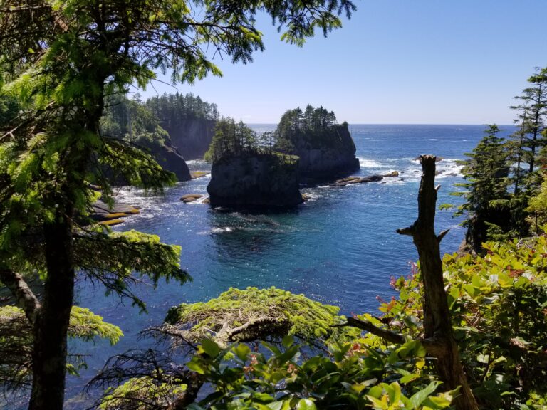
Back in Port Angeles and heading west on US 101, it’s five miles to a major fork in the road. If you follow Highway 112 west, you’ll continue along the shoreline on the Strait of Juan de Fuca Highway, a 65-mile National Scenic Byway with farms, campgrounds, inns, cafés and beach access. The byway ends in Neah Bay with food, fuel and the Makah Cultural & Research Center, where 300 to 500 year old artifacts from a nearby archaeological site and other tribal objects are exhibited at the Makah Museum. Where one byway ends, another one starts as the Cape Flattery Tribal Scenic Byway makes the final eight-mile westward push to the Pacific Ocean as it crosses the ancestral home of the Makah Tribe. The road ends at a parking area where trails lead through forest to striking overlooks. Just offshore lie several small islands the Makah people have fished for generations.
Back at the major fork five miles outside of Port Angeles, if you continue west on US 101, the road trip travels through the northern edge of Olympic National Park while skirting the southern shore of Lake Crescent. You’ll pass several trailheads and waterfalls before reaching Sol Duc Road, about 22 miles from the fork. Follow the road south for 5.5 miles as it penetrates the forest to the Sol Duc Hot Springs Resort with cabins, a campground, swimming pool, hot mineral pools, restaurant and shop. A 1.6 roundtrip trail through moss-draped old-growth trees leads to Sol Duc Falls.
Back on US 101, it’s 15 miles west to Sappho and Highway 113. If you follow this road 10 miles north, it will connect with Highway 112 and the Strait of Juan de Fuca National Scenic Byway. Staying on US 101, from Sappho the highway curves south and in 12 miles reaches Forks, a small town with motels, campgrounds and a few restaurants. At one time, Forks called itself the “Logging Capital of the World,” and you can investigate this claim at the Forks Timber Museum. Driving past the imposing artwork made of hundreds of buoys outside John’s Beachcombing Museum is enough to lure many curious visitors inside. In the 1970s, John Anderson started beachcombing and today, his museum holds thousands of ocean treasures he’s gathered. Many people come to Forks in search of vampires and werewolves, too. As the setting for Twilight, the hit book and movie series, fans can take a self-guided tour around town, including the Rainforest Arts Center’s collection of costumes and props from the five Twilight films. From Forks, a 15 mile one-way detour west on Highway 110 to La Push in the Quileute Nation leads to beaches, tidepools and barbecued salmon at River’s Edge Restaurant.
Continuing south on US 101, it’s 5.5 miles from Forks to Bogachiel State Park with camping, hiking and freshwater swimming in a forested setting along the Bogachiel River. The park is also an access point for the 1,200-mile Pacific Northwest National Scenic Trail, running west to east from the Pacific Ocean to the Continental Divide in Montana.
Driving south of the state park on US 101, go 7.5 miles to Upper Hoh Road where a left turn leads into the western part of Olympic National Park. It’s 18 miles to the Hoh Rain Forest Visitor Center with a campground and hiking trails. Like all parts of the national park in summer, this area gets really busy, and you must make camping reservations mid-May through mid-September.
Back on southbound US 101, a particularly scenic stretch lies ahead as the highway approaches the Pacific. A must-stop is Ruby Beach, where sea stacks, gigantic logs and red sand that occasionally accumulates make this a frequent choice on lists of the world’s best beaches. Ruby Beach is 14 miles from the Upper Hoh Road turnoff and 27 miles from Forks.
From Ruby Beach, US 101 follows the Pacific for 13 miles and then heads inland at Queets. In another 23 miles, look for Quinault North Shore Road and go left. This is the start of Quinault Rain Forest Loop Drive, a 27 mile trek into the southwestern section of Olympic National Park that follows Lake Quinault and the Quinault River with numerous camping areas and trailheads.
Once the loop route returns to US 101, continue south about 5.5 miles to Cook Creek Road. If you turn right, Cook Creek goes 21 miles to Moclips and several more Pacific beach towns. Continuing south on US 101 another 38 miles, the highway reaches Hoquiam and Aberdeen, neighboring communities on the shores of Grays Harbor with lodging, restaurants and shopping. Aberdeen is the hometown of rocker Kurt Cobain. It’s also the home port of The Lady Washington, a full-scale replica of the original tall ship, the first American vessel to make landfall on North America’s west coast in 1788. The Lady Washington offers sailing trips throughout the Puget Sound so check her schedule to book. When in port, she’s often open for self-guided tours. Another beauty worth exploring is the Polson Museum. This National Historic Site features a restored 1924 mansion with gardens, outdoor machinery displays and local history exhibits in several of the mansion’s rooms. From Aberdeen, it’s 49 miles east on Highway 8 to Olympia, completing this looping road trip of the Olympic Peninsula.
Magnificent Mount Rainier
Chinook Scenic Byway & White Pass Scenic Byway – 300 miles, from Enumclaw to Mt. Rainier to Yakima via Chinook Pass and then back to Mt. Rainier via White Pass and Packwood, ending at I-5
Few mountains dominate a landscape like Mount Rainier. Washington’s tallest peak looms 14,411 feet above sea level, dwarfing every nearby landform. On a clear day, it’s a striking addition to postcard views of downtown Seattle and Tacoma. This road trip combines the two scenic byways providing up close exploration of Mount Rainier. Chinook Scenic Byway, an All-American Road, skirts the top of the volcano as it heads east to Yakima, a sublime agricultural area with breweries, vineyards and James Beard-worthy food. Returning west, White Pass National Scenic Byway showcases the southern side of Mount Rainier with more forests, lakes and fishing.
Chinook Scenic Byway
From Tacoma, it’s 27 miles east to Enumclaw where the Chinook Scenic Byway starts. Located in the shadow of Mount Rainier and surrounded by farmland, the well-kept downtown has restaurants, breweries, a pie shop, a distillery and the Thunder Dome Car Museum with a rotating collection of vintage and exotic vehicles. Then, follow Highway 410 east where it soon begins to parallel the White River, one of five large rivers originating from Mount Rainier’s 28 major glaciers.
From Enumclaw, it’s 17 miles to Federation Forest State Park. With more than 12 miles of trails winding through old growth forest covered in moss, this is primarily a hiking destination. There’s an interpretive center which is open April through October but no camping.
As Highway 410 continues to ascend Mount Rainier through Mount Baker-Snoqualmie National Forest, there are campgrounds, pullouts for trailheads and waterfall viewpoints. From the state park, it’s 16 miles to the turnoff for Crystal Mountain where a winding six mile road leads up the mountainside to the ski resort, which becomes a summer haven for hiking, disc golf and RVing. There’s also a scenic gondola ride and aerial adventure course.
Back on Highway 410, it’s another six miles from the Crystal Mountain turnoff to Sunrise Road and the White River Entrance to Mount Rainier National Park. Keep in mind that the route from Enumclaw to Crystal Mountain is open year-round but Sunrise Road (and the upcoming Chinook Pass) is closed from November through April. You have to make a timed reservation and pay the park entrance fee to drive Sunrise Road’s spectacular 14 miles which ends at a visitor center. There are pullouts, hiking trails and a first-come, first-served campground.
Continuing on Highway 410 and the Chinook Scenic Byway, it’s 3.5 miles to the intersection of Highway 123. If you veer right and continue south on this road, you’ll drive through the national park’s eastern side which includes more trailheads, waterfalls and the Ohanapecosh Visitor Center and campground. Highway 123 also provides access to the Paradise Corridor, another route requiring timed reservations and a fee. Check out the Mount Rainier National Park website for more details. Highway 123 is closed in the winter and runs 16 miles before ending at US 12, the White Pass Scenic Byway which we’ll profile next.
Back where Highway 123 heads south from Highway 410, the Chinook Scenic Byway climbs east through forest, clinging to the mountainside with sheer drop-offs and stunning views as it crosses Chinook Pass. This is a spring, summer and fall experience as the pass is closed in winter. The Pacific Crest National Scenic Trail, which runs from Canada to Mexico, also crosses the road here. Through quiet now, Mount Rainier is an active volcano, and its most recent eruption cycle ended about 1,000 years ago. As the highway works its way down Mount Rainier’s eastern slope, you’re now driving through the Okanogan-Wenatchee National Forest with more campgrounds, trailheads and waterfalls. A particularly popular hike requiring reservations is Boulder Cave, where a 1.5 mile roundtrip trail passes through a 330-foot cave made of volcanic rock eroded over time by Devil Creek. It’s about 35 miles from the White River Entrance to Boulder Cave.
From Boulder Cave, Highway 410 continues 22 miles east where it merges with US 12 and the White Pass Scenic Byway. At this intersection and to the left is Old Naches Road and the Oak Creek Big Horn Sheep Feeding Station. It’s only ½ mile drive to see if any animals are there so it’s worth a quick detour.
Following US 12, it’s another 18 miles to Yakima, an up-and-coming city boasting 300 days of annual sunshine. While western Washington gets the rain and gloom, Mount Rainier and the Cascade Range largely shield the state’s central region. The volcanic soil and long, hot summer days have created an agricultural paradise, where more than 40 commercial crops are grown. There are 90+ wineries in the Yakima Valley and breweries are big here, too, considering the area produces more than 75% of the USA’s hops. Yakima has some excellent restaurants, too. The James Beard Foundation Awards, considered the Oscars of the food world, have taken notice of Yakima. Crafted is a higher-end restaurant owned by Dan Koommoo, a James Beard-nominated chef. And Los Hernandez Authentic Tamales won a James Beard award for its signature item which comes in pork, chicken and seasonal varieties like asparagus, cactus or jalapeno with pepper jack cheese. Not surprisingly, farming is front and center at three local museums: Yakima Valley Museum, Central Washington Ag Museum and American Hop Museum. Members of the Yakima Nation are the area’s traditional landowners, and you can learn about their culture and history at the Yakama Nation Museum. It’s one of the oldest Native American museums in the U.S. and includes a gift shop with authentic crafts including beadwork, blankets and silver.
White Pass Scenic Byway
From Yakima, you can return to the western side of the state on the White Pass Scenic Byway which follows US 12 along the south side of Mount Rainier National Park before ending at I-5. Unlike Chinook Pass and Highway 410, this scenic byway and US 12 are open year-round.
Driving west on US 12 the same way you arrived, it’s 18 miles from Yakima to Highway 410. Instead of going northwest toward the national park and Enumclaw, continue west on US 12. In about two miles you’ll pass through the Oak Creek Wildlife Area, known for wildflowers and mule deer, bighorn sheep, mountain goats, turkey and other species. In winter, hundreds of elk gather at the Elk Feeding Station. You’re venturing into the Okanogan-Wenatchee National Forest and after that, the Gifford Pinchot National Forest so be sure to research hiking trails and whether or not you’ll need reservations for the numerous campgrounds along the route. The highway runs parallel to the Tieton River, where fisherman come for rainbow trout and whitefish. In September, whitewater rafting is popular as the river rages once water is released from Rimrock Dam to irrigate the Yakima Valley.
From the Oak Creek Wildlife Area, it’s 18 miles to Rimrock Lake with more fishing and several campgrounds. As the highway steadily climbs in elevation, the landscape becomes more lush as you transition into the wetter forests of western Washington. Soon, the byway crosses the Pacific Crest National Scenic Trail and then White Pass where there’s also a ski area. Driving US 12, the views of colossal Mount Rainier are spectacular with many pullouts for photos. There’s a waterfall at the Lava Falls Viewpoint and volcanic palisades rock formations at Palisades Viewpoint. From White Pass, go 12 miles to Highway 123 which heads north through Mount Rainier National Park’s eastern side to the Ohanapecosh Visitor Center and the Paradise Corridor. It’s 16 miles to the Chinook Scenic Byway, as profiled above, and remember, Highways 123 and 410 shut down in the winter.
Continuing west, US 12 begins to parallel the Cowlitz River as it heads 7.5 miles to the little town of Packwood with fuel, groceries, hamburgers, coffee, a hardware store and brewery. Then, in 16 miles US 12 passes through Randle, with views of Mt. Adams, another iconic Washington volcano. About 17.5 miles west and you’re in Morton with more food and lodging options. Morton lies north of Riffe Lake, another large reservoir with boating, fishing, camping and hiking. You’re also north of Mount St. Helens, which blew its top during a massive eruption in 1980. For a great view of the volcano on a clear day, from Morton continue 3.3 miles west on US 12 and take a right onto Short Road. Then drive 1.3 miles north to the Hopkins Hill Viewpoint, GPS coordinates N 46° 33.143 W 122° 20.995.
Back where Short Road left the scenic byway, continue west on US 12 seven miles to Highway 122 and go right. In less than four miles you’ll reach Ike Kinswa State Park, set along the shores of 13 mile-long Mayfield Lake. Surrounded by thick forest, the lake is a tranquil setting for swimming, boating, hiking, fishing, kayaking, birding and camping. There are several other parks and RV campgrounds around the lake, too.
Mayfield Lake is fed by the Cowlitz, one of the five major rivers with headwaters at Mount Rainer. If you and your small fry want to learn about local fish and their habitats, there are two nearby hatcheries. From Ike Kinswa State Park go west on Highway 122 for four miles which puts you back on the scenic byway and US 12. Head west for two miles and then take a left onto Fuller Road. It’s less than two miles to the Cowlitz Salmon Hatchery Visitor Center with educational exhibits and a self-guided tour of outdoor areas. The second hatchery, Cowlitz Trout Hatchery, is another six miles west of the salmon hatchery following Spencer Road. The trout hatchery doesn’t have a fancy educational center, but it does provide river access and camping in the parking lot.
Lewis & Clark State Park is the byway’s final stop. It’s about 8.5 miles northwest of the trout hatchery and 17 miles west of Ike Kinswa State Park following US 12 and Jackson Highway. Set deep in old-growth forest, Lewis & Clark is an ideal misty, mossy Pacific Northwest experience with camping, hiking, picnicking, biking and horseback riding.
From Lewis & Clark, it’s about 4.5 miles to I-5 and another 95 miles north to Seattle and 77 miles south to Portland, Oregon.
Coulee Corridor Scenic Byway
210 miles, from Ginkgo Petrified Forest to Othello to Moses Lake to Grand Coulee and Omak
Traveling south to north, this road trip explores the heart of Washington from Othello to Omak. If you’re driving from Seattle on I-90, Ginkgo Petrified Forest State Park is a fascinating first stop on the way to Othello. From Seattle, I-90 heads east, going up and over the Cascade Range, leaving wet and lush western Washington for the dry and desert-like center. In 135 miles, exit the freeway at Vantage, a little town on the Columbia River. Just to the north is Ginkgo Petrified Forest, providing an excellent introduction to the region’s geological history. The state park has several hiking trails including the Trees of Stone Interpretive Trail, which weaves through petrified logs in their original setting. Perched on a bluff overlooking the Columbia River, the Ginkgo Interpretive Center has exhibits, a gift shop and amazing views of the water. Just south of Vantage is Wanapum Recreation Area with several miles of shoreline and camping.
From Vantage, go 43 miles east on Highway 26 to Othello, another small town with gas, groceries and fast food. Following McManamon Road six miles northwest of Othello is the sprawling Columbia National Wildlife Refuge with cliffs, canyons, grasslands, lakes and marshes. Hiking, fishing and hunting are popular along with wildlife watching and birding. The refuge attracts large numbers of migrating and wintering mallards, Canada geese, tundra swans and other waterfowl. The Drumheller Channels National Natural Landmark is a fascinating area to hike and photograph the region’s unique geography, characterized by buttes, basalt columns and valleys.
There’s no camping at the refuge so continue roughly 10 miles northwest to Potholes State Park with a campground and access to Potholes Reservoir, a beauty of a lake with swimming, kayaking, paddleboarding and waterskiing. There’s year-round fishing for crappie, largemouth bass, rainbow trout, yellow perch and walleye. Birds love the water here, too, with plenty of watchable waterfowl.
From Potholes, it’s 19 miles east and north to Moses Lake where you’ll cross over I-90 to find motels, RV parks, restaurants and the Surf ‘n Slide Water Park. Then, continue 23 miles north on Highway 17, passing through agricultural fields to Soap Lake, both a town and body of water.
Driving the desert terrain is when the “coulee” in this national scenic byway’s name really becomes apparent. A coulee is a ravine or gully that’s usually dry but was once cut by water. Lava formed the basalt walls of the coulee millions of years ago. Then, some 12,000 years ago, catastrophic glacial flooding carved the coulee. From Soap Lake, it’s six miles to Lake Lenore Caves State Park where a trail overlooking the lake and valley climbs past a series of shallow basalt caves made by the glacial flooding. Later, humans used the caves as shelters.
Continuing north 9.5 miles through coulee country on Highway 17, the next attraction is Sun Lakes-Dry Falls State Park where a 400 foot-high, 3.5 mile-wide cliff sits above lakes reflecting the surrounding gorge walls. During the Ice Age Floods, a waterfall four times the size of Niagara Falls thundered over the now silent cliff. The Dry Falls Visitor Center tells the park’s story through interpretive displays. Camping, hiking, biking, boating, kayaking and fishing are bigtime activities. There’s also a nine-hole golf course and an 18-hole mini golf course.
From Sun Lakes, it’s 7.5 miles on Highway 17 and US 2 to Coulee City, a tiny community on Banks Lake with a waterside campground. From US 2, take Highway 155 north driving alongside Banks Lake for some 16 miles until reaching Steamboat Rock State Park. The main part of the park lies on the northern half of a peninsula jutting into Banks Lake. Boating and year-round camping are the major activities while Northrup Canyon is a highly recommended hike through pine forest. In winter, as many as 200 bald eagles roost in the trees along the canyon’s south side every night, taking flight in the early morning.
It’s about ten miles north from the state park to Grand Coulee, where you find coffee, groceries and more campgrounds. With Banks Lake to one side and the Columbia River to the other, the town’s location is pretty and peaceful. But its claim to fame is the adjacent Grand Coulee Dam, one of the world’s largest concrete structures and the biggest hydropower producer in the U.S. You can learn about the dam at the visitor center and there’s also a free nightly outdoor laser light show from late May through September.
From Grand Coulee, the scenic byway continues three miles north, crossing over the Columbia River and entering the Colville Reservation. Just north of the Grand Coulee Dam, the Confederated Tribes of the Colville Reservation has a museum displaying basketry, beadwork, clothing and tools. The gift shop sells crafts, quilts, books, cards and posters.
Highway 155 heads north and west through the Colville Reservation another 51 miles before ending in Omak, a small agricultural town on the Okanogan River with campgrounds, homestyle restaurants like Breadline Café and an annual rodeo, the Omak Stampede that started in the 1930s.
Palouse Scenic Byway
300 miles, from Spokane Valley to Pullman to the Snake River to Palouse Falls and Walla Walla
Monet, Renoir and van Gogh would have found plenty of inspiration in The Palouse. The rolling hills of this distinct geographic area of southeastern Washington are suited for an impressionist’s artwork. From spring through summer and fall, the hills shift from various shades of green and gold to brown and white as plants grow, harvest finishes and winter snow arrives. The fertile hills of The Palouse are made of loess, windblown dust and silt accumulated over thousands of years. This is another one of Washington’s major agricultural areas, where wheat, barley, lentils, hops and onions are primary crops. This road trip meanders south from Spokane along Washington’s border with Idaho to Pullman, heads west to the extraordinary Palouse Falls and then goes south, ending in Walla Walla, one of the world’s rising wine growing areas.
From Spokane, drive 10 miles east on I-90 to Spokane Valley and then head south on Highway 27 and the start of the Palouse Scenic Byway. Most drivers get to Pullman via busy US 195, but the scenic byway is definitely more casual and picturesque as it winds around hills and up and down valleys, passing by farms and barns. After cruising through the small towns of Rockford, Fairfield and Takoa, from Spokane Valley it’s 51 miles to Oakesdale. As you head through, take a look at the J. C. Barron Flour Mill, an imposing structure built in 1890. Wheat has been an important crop for decades and about two dozen flour mills were constructed in eastern Washington and the Idaho Panhandle. The Barron Flour Mill ceased operations in 1960 and is the best preserved of the region’s remaining historic mills.
From Oakesdale, go south another mile on Highway 27 and then take a right onto Hume Road for an eight mile detour to Steptoe Butte State Park. If you want an overview of The Palouse, this is the byway’s most artistic panorama where the vivid farmland, hills and mountains stretch to the horizon. There’s no camping but you can grill, picnic, bird watch and even paraglide.
Back on Highway 27, it’s 20 miles from Oakesdale to the town of Palouse offering food, a brewery, RV park and the Roy M. Chatters Newspaper and Printing Museum with printing presses and Linotype machines. It’s open Saturdays from 10 to 2 or by appointment. Then, for another inspiring vista, continue five miles south of Palouse on Highway 27 and Fugate Road to Kamiak Butte, a county park with forested hiking trails, picnic areas and grills.
From Kamiak Butte, it’s about 13 miles to Pullman, home to Washington State University. Along with nearby Moscow and the University of Idaho, the two college towns make an enticing destination with good restaurants and art, hiking and biking trails, a strong local theater and music scene and interesting museums such as WSU’s Museum of Anthropology and S. Elroy McCaw Fluorescent Mineral Display Museum. From April to October, you can watch grizzlies in their secure double-fenced roaming area at the WSU Bear Center. Seventeen miles south of Pullman in Uniontown, the Dahmen Barn sits grandly in a field, surrounded by a rustically elegant fence made of rusty wheels. Constructed in 1935, the barn was part of a commercial dairy operation and then sat vacant and decaying for 50 years. Today, the barn has been renovated and transformed into studio spaces where artists showcase their work and sell directly to the public. The barn also hosts classes and music events.
Pullman is also relatively close to the Snake River, where blue water cuts through a weathered gorge. From downtown, make your way to Highway 194 and go about 2.5 miles west until it forks. If you go left onto Wawawai-Pullman Road, you’ll reach the river’s edge at Wawawai County Park, 19 miles from Pullman. The park has picnicking, camping, fishing and water sports. The gorgeous route continues past the park as Wawawai Road follows the river another 27 miles south to Clarkson. Wawawai County Park lies south of the Lower Granite Dam. To reach attractions on the dam’s northside, return to the fork. If you go right onto Highway 194, it will take you back to Pullman. But if you go left, Highway 194 ends in Almota, a ghost town on the Snake River, 23 miles from Pullman and 31 miles from Wawawai County Park. Boyer Park & Marina keeps the area lively with camping cabins and 60+ RV sites. There’s a restaurant, store, sandy beach, boat docks and a paved four-mile walking path along the river to the Lower Granite Dam.
Back on the Palouse Scenic Byway, head 15.5 miles north of Pullman on US 195 to Colfax and The Codger Pole, a 65-foot-tall wooden sculpture made of four cedar logs. Carved by a chainsaw, the pole features the faces and helmets of 51 football players and two team mascots who competed in a 1988 grudge game between Colfax and its rival, St. John. The original, fully uniformed contest happened in 1938, and when the touch rematch happened fifty years later, most of the players were in their 70s.
From Colfax, go 50 miles west on Highway 26 to Washtucna and then 17 miles south and east on Highway 261 to one of Washington’s crown jewels, Palouse Falls, the official state waterfall. In a state packed with incredible natural attractions, Palouse Falls is one of the most remarkable as the Palouse River runs through a narrow chute and then plunges 198 feet. From the churning pool below, the river rages through a gorge of columnar basalt on its way to the Snake River, a few miles downstream. The setting isn’t for the faint of heart as the three viewpoints lie along the cliff’s edge, with the falls in one direction and the canyon in the other. The park gets busy so plan accordingly and there’s no camping. To see the confluence of the Palouse and Snake rivers, it’s about eight miles from Palouse Falls on Highway 261 to Lyons Ferry State Park with swimming, boating, fishing, paddleboarding and kayaking but no camping.
Though just outside The Palouse and not on the byway, it’s worth visiting Walla Walla, some 50 miles south of Lyons Ferry depending on which route you take. About 35 miles from Lyons Ferry on US 12, Lewis & Clark Trail State Park has camping and swimming. Then, continue into Walla Walla which has several campgrounds and lodging in all classes. The city has a few museums and a charming downtown with boutiques, breweries and some topnotch restaurants. But the main reason tourism is thriving here is because Walla Walla has become one of the nation’s best wine regions with 130 wineries, nearly 3,000 acres of grapes and countless awards.